Sites and Monuments Record · Ireland
Graveyard
Ardbraccan, County Meath, Ireland
The record
- Townland
- Ardbraccan
- County
- Meath
- Country
- Ireland
- First-edition OS map
- Indicated
- Latest-edition OS map
- G. Yd.
- Coordinates
- 53.65808, -6.74692
- SMR number
- ME025-022001-
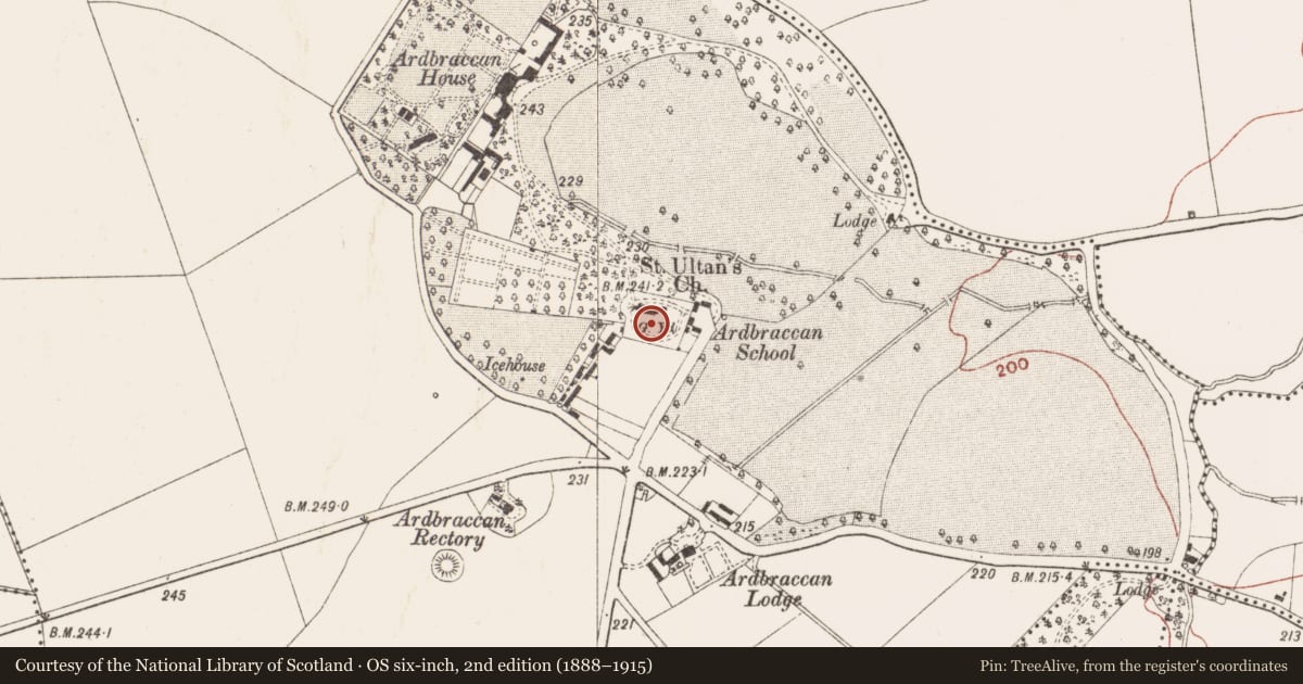
Slide toward Today to fade the historical sheet and see the modern map underneath.
David Rumsey Map Collection, Stanford LibrariesDavid Rumsey Map Collection, Stanford LibrariesDavid Rumsey Map Collection, Stanford LibrariesDavid Rumsey Map Collection, Stanford Libraries
4 historical maps cover this location, the earliest the 1790 map "Composite: Ireland." (David Rumsey Map Collection, Stanford Libraries).
Historical maps covering this location
- 1790 · Composite: Ireland. (David Rumsey Map Collection, Stanford Libraries)
- 1799 · Ireland. (David Rumsey Map Collection, Stanford Libraries)
- 1811 · Ireland. (David Rumsey Map Collection, Stanford Libraries)
- 1891 · Ireland 16 (David Rumsey Map Collection, Stanford Libraries)
This record in the National Monuments Service's Historic Environment Viewer ↗
The National Monuments Service's description
The early church the site and the site of the parish church of Ardbraccan (ME025-022----) is located on a rise in a level landscape and is within a rectangular graveyard (dims c. 80m E-W; c. 65m N-S) defined by masonry walls (H c. 3m). According to Dopping's Visitation (1682-5) the church was already enclosed by a stone wall at that time (Ellison 1972, 10). The Montgomery tomb and other fragments are within the graveyard. Archaeological testing (15E0336) by A. Collins c. 40m W of the graveyard produced no related material (excavations.ie 2015:344), and further testing (18E0524) by E. Sullivan (2019) in a small area (dims c. 10m x c. 4m) c. 45m SW of the graveyard had a similar result.
See attached general view of the church and graveyard from the E.
Compiled by: Michael Moore
Date of upload: 3 July, 2014
Amended: 5 February 2021, 9 April, 2021
References
Ellison, Rev. C. C. 1971-5 Bishop Dopping's Visitation Book 1682-5, Ríocht na Mídhe, 5, 1, 28-39; 5, 2, 3-13; 5, 3, 3-11; 5, 4, 98-103; 6, 1, 3-13.
Sullivan, E. 2019 Licensed Archaeological Monitoring at Ardbraccan, Navan, Co. Meath. Licence: 18E0524. Unpublished report, Gort Archaeology
Nearby in the register
- Tomb - chest tombunder 1 mi
- Tomb - chest tombunder 1 mi
- Churchunder 1 mi
- Graveslabunder 1 mi
Other entries of the same register within about three miles of this one, by straight line.