Sites and Monuments Record · Ireland
Pit
Grange (Navan Lower By.), County Meath, Ireland
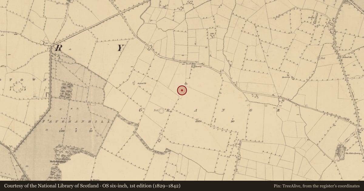
The record
- Townland
- Grange (Navan Lower By.)
- County
- Meath
- Country
- Ireland
- First-edition OS map
- Not indicated
- Latest-edition OS map
- Not indicated
- Coordinates
- 53.67404, -6.78151
- SMR number
- ME024-034001-
Slide toward Today to fade the historical sheet and see the modern map underneath.
David Rumsey Map Collection, Stanford LibrariesDavid Rumsey Map Collection, Stanford LibrariesDavid Rumsey Map Collection, Stanford LibrariesDavid Rumsey Map Collection, Stanford Libraries
4 historical maps cover this location, the earliest the 1790 map "Composite: Ireland." (David Rumsey Map Collection, Stanford Libraries).
Historical maps covering this location
- 1790 · Composite: Ireland. (David Rumsey Map Collection, Stanford Libraries)
- 1799 · Ireland. (David Rumsey Map Collection, Stanford Libraries)
- 1811 · Ireland. (David Rumsey Map Collection, Stanford Libraries)
- 1891 · Ireland 16 (David Rumsey Map Collection, Stanford Libraries)
This record in the National Monuments Service's Historic Environment Viewer ↗
The National Monuments Service's description
Situated at the N end of a NW-SE ridge (L . 300m) and at its highest point. Archaeological testing (04E0925) by J. Roynane (2005) at Testing Area 2 of Contract 4 of the M3 motorway identified archaeological material (excavations.ie 2004:1245) that was excavated (E003124) by A. Kelly (2011) as Grange 2 in late June/July 2006 (excavations.ie 2007:1321) when two Neolithic pits, a small burial ground, and evidence of metalworking were recorded in an area of just over 800 square metres. A subcircular pit (dims 0.65m x 0.47m; D 0.14m) had two fills of brown silty clays that produced six sherds from at least two Early Neolithic carinated bowls. A sample of carbonized hazelnut shell provided a C14 date of 3654-3527 cal. BC (UB 12074). A circular pit (diam. 0.7m; D 0.5m) 4m to the N is thought to be related as both were within the Late Iron Age cemetery. This pit was lined with stones and was filled with a brown silty clay but the only artefact recovered was a flint flake. (Kelly 2011, 5,6)
See the attached site-plan from Kelly (2011, fig. 6)
Compiled by: Michael Moore
Date of upload: 24 March 2022
References
Kelly, A. 2011 M3 Clonee – North of Kells, Contract 4, Navan to Kells and Kells Bypass. Final Report on Grange 2, Co. Meath. Licence: E003124. Unpublished report, Irish Archaeological Consultancy
Roynane, J. 2005 M3 Clonee-North of Kells; Contract 4, Navan - Kells and Kells Bypass. Report on Archaeological Assessment at Testing Area 2 in Grange, County Meath. Licence: 04E0925. Unpublished report, Irish Archaeological Consultancy
Nearby in the register
- Burial groundunder 1 mi
- Metalworking siteunder 1 mi
- Ring-ditchunder 1 mi
- Enclosureunder 1 mi
Other entries of the same register within about three miles of this one, by straight line.