Sites and Monuments Record · Ireland
Cross - Wayside cross
Kilskeer, County Meath, Ireland
The record
- Townland
- Kilskeer
- County
- Meath
- Country
- Ireland
- First-edition OS map
- Not indicated
- Latest-edition OS map
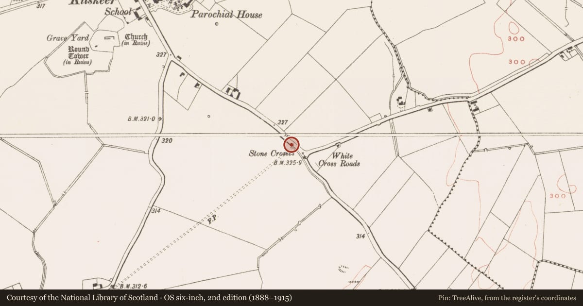
- Stone Cross
- Coordinates
- 53.68843, -6.98923
- SMR number
- ME023-005002-
Slide toward Today to fade the historical sheet and see the modern map underneath.
David Rumsey Map Collection, Stanford LibrariesDavid Rumsey Map Collection, Stanford LibrariesDavid Rumsey Map Collection, Stanford LibrariesDavid Rumsey Map Collection, Stanford Libraries
4 historical maps cover this location, the earliest the 1790 map "Composite: Ireland." (David Rumsey Map Collection, Stanford Libraries).
Historical maps covering this location
- 1790 · Composite: Ireland. (David Rumsey Map Collection, Stanford Libraries)
- 1811 · Ireland. (David Rumsey Map Collection, Stanford Libraries)
- 1869 · Ireland. (David Rumsey Map Collection, Stanford Libraries)
- 1891 · Ireland 16 (David Rumsey Map Collection, Stanford Libraries)
This record in the National Monuments Service's Historic Environment Viewer ↗
The National Monuments Service's description
Situated at the W side of the SE-NW R154 road from Athboy to Kilskeer, c. 600m SE of the village of Kilskeer and just NW of White Cross Roads. A limestone latin cross (H c. 1m; span c. 0.6m; T c. 0.5m) is set on an octagonal stand, which is sitting on a masonry pier (dims c. 2m N-S x c. 1m E-W; H c. 2m). An inscription in black lettering on white polished marble on the E face of the pier reads: Of your charity / pray for the / soul of / Richard Conwell / who died Nov. 7 1857 / May he rest / in peace / Amen.
Compiled by: Michael Moore
Date of upload: 6 May, 2015
Nearby in the register
- Crossunder 1 mi
- Ritual site - holy wellunder 1 mi
- Field systemunder 1 mi
- Structureunder 1 mi
Other entries of the same register within about three miles of this one, by straight line.