Sites and Monuments Record · Ireland
Castle - motte and bailey
Newtown (Fore By., Killallon ED), County Meath, Ireland
The record
- Townland
- Newtown (Fore By., Killallon ED)
- County
- Meath
- Country
- Ireland
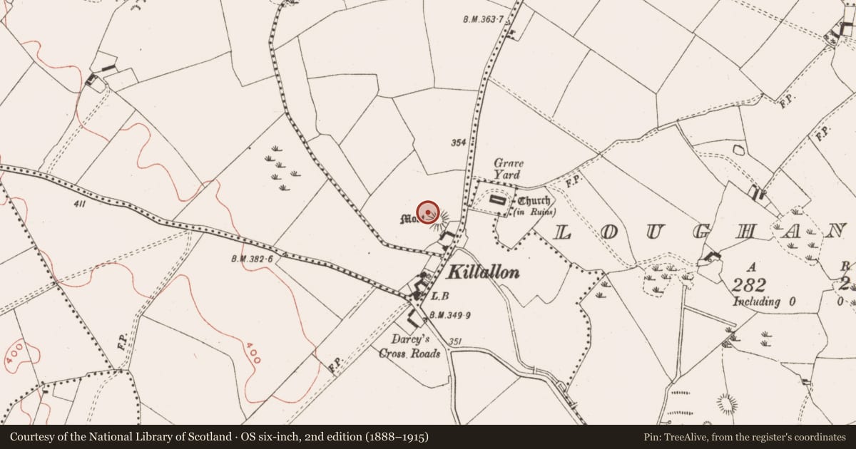
- First-edition OS map
- Moat
- Latest-edition OS map
- Moat
- Coordinates
- 53.67958, -7.06316
- SMR number
- ME022-010----
Slide toward Today to fade the historical sheet and see the modern map underneath.
David Rumsey Map Collection, Stanford LibrariesDavid Rumsey Map Collection, Stanford LibrariesDavid Rumsey Map Collection, Stanford LibrariesDavid Rumsey Map Collection, Stanford Libraries
4 historical maps cover this location, the earliest the 1790 map "Composite: Ireland." (David Rumsey Map Collection, Stanford Libraries).
Historical maps covering this location
- 1790 · Composite: Ireland. (David Rumsey Map Collection, Stanford Libraries)
- 1811 · Ireland. (David Rumsey Map Collection, Stanford Libraries)
- 1869 · Ireland. (David Rumsey Map Collection, Stanford Libraries)
- 1891 · Ireland 16 (David Rumsey Map Collection, Stanford Libraries)
This record in the National Monuments Service's Historic Environment Viewer ↗
The National Monuments Service's description
Situated in a gently undulating landscape. Killallon was known as Killamlan, and in 1214-5 William de Tuite reportedly found gold there (Orpen 1907, 241). The motte is a subcircular flat-topped mound (dims of top 17.5m E-W; 15m N-S; diam. of base 40m N-S; 36m E-W; H 7m at NW to 14m at SE) with a rectangular, grass-covered bailey (int. dims c. 40m NW-SE; c. 40m NE-SW), defined by earthen banks (at NW: Wth of base 15m; int. H 1m; ext. H 0.6m) or scarps, attached to the NW. It is associated a field system (ME022-007----) just to the NW. The castle site (ME022-011----) is just N of the bailey and Killallon parish church (ME022-012----) is c. 90m to the NE.
The above description is derived from the published 'Archaeological Inventory of County Meath' (Dublin: Stationery Office, 1987). In certain instances the entries have been revised and updated in the light of recent research.
Compiled by: Michael Moore
Date of revision: 21 July 2016
Amended: 23 March 2023
References
Orpen, G.H. 1907 Motes and Norman castles in Ireland. Journal of the Royal Society of Antiquaries of Ireland 37, 123-52.
Nearby in the register
- Castle - unclassifiedunder 1 mi
- Moundunder 1 mi
- Graveyardunder 1 mi
- Churchunder 1 mi
Other entries of the same register within about three miles of this one, by straight line.