Sites and Monuments Record · Ireland
Fulacht fia
Sheephouse, County Meath, Ireland
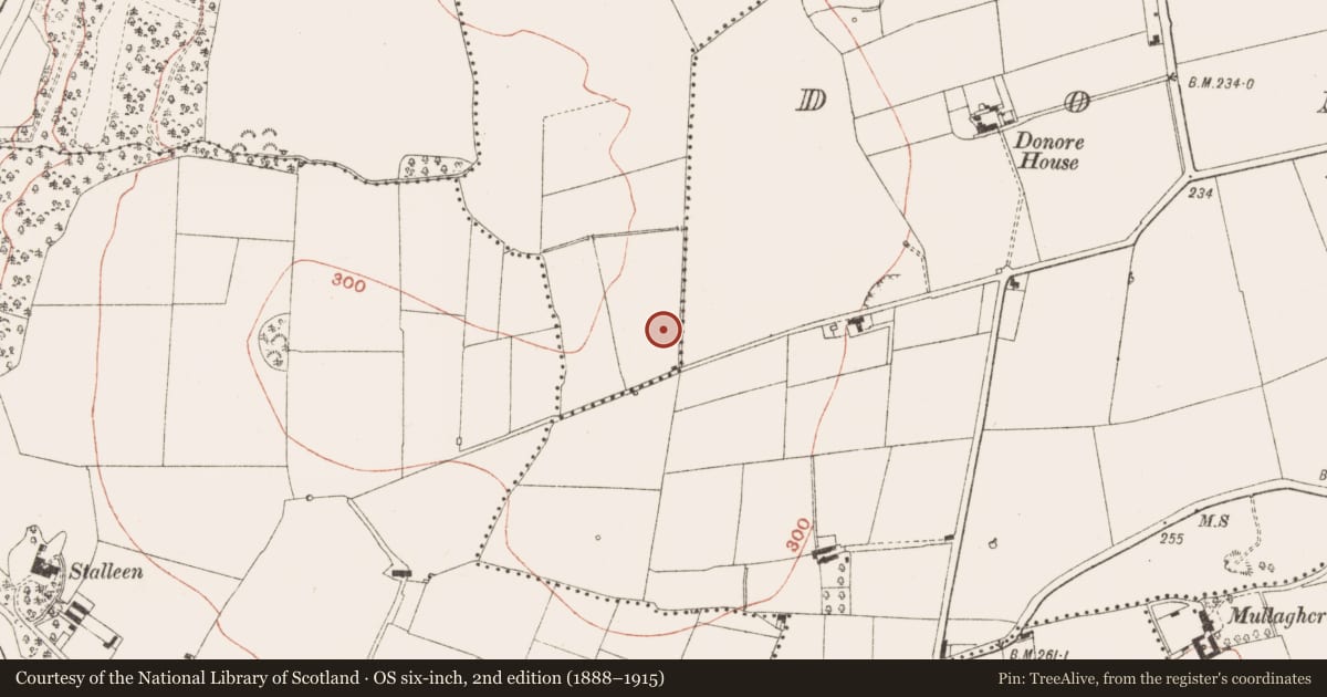
The record
- Townland
- Sheephouse
- County
- Meath
- Country
- Ireland
- First-edition OS map
- Not indicated
- Latest-edition OS map
- Not indicated
- Coordinates
- 53.69834, -6.41715
- SMR number
- ME020-029003-
Slide toward Today to fade the historical sheet and see the modern map underneath.
David Rumsey Map Collection, Stanford LibrariesDavid Rumsey Map Collection, Stanford LibrariesDavid Rumsey Map Collection, Stanford LibrariesDavid Rumsey Map Collection, Stanford Libraries
4 historical maps cover this location, the earliest the 1790 map "Composite: Ireland." (David Rumsey Map Collection, Stanford Libraries).
Historical maps covering this location
- 1790 · Composite: Ireland. (David Rumsey Map Collection, Stanford Libraries)
- 1799 · Ireland. (David Rumsey Map Collection, Stanford Libraries)
- 1811 · Ireland. (David Rumsey Map Collection, Stanford Libraries)
- 1891 · Ireland 16 (David Rumsey Map Collection, Stanford Libraries)
This record in the National Monuments Service's Historic Environment Viewer ↗
The National Monuments Service's description
Situated on a broad hollow on the NW-facing slope of Platten. Archaeological excavation (E000973) recorded a rectangular spread of burnt stone (dims 10.5m N-S; 6m E-W; max. T 0.4m) that sealed a rectangular trough (dims 0.95m x 0.7m; D 0.6m) cut into the shale bedrock at N. Beneath the spread at the S was a possible hearth visible as a circular spread of silty clay with charcoal (diam. c. 1m; T 0.2m). Recovered from the stone spread was a burnt fragment of a stone axe. Extending NW from the stone spread were 7 pits (diam. 0.7-1.3m; D 0.1-0.7m) filled with burnt stone. Fulacht fia (ME020-029002-) is c. 50m to the W and the burnt spread (ME020-029001-) is c. 100m to the N. (Campbell 1994 3, 4 site 2; 1995e, 73-4)
Compiled by: Michael Moore
Date of upload: 23 October, 2015
References
Campbell, K. 1994 Donore North quarry: preliminary archaeological report. Licence: E000973. Unpublished report. Author.
Campbell, K. 1995e Sheephouse. Fulachta fiadh. in I. Bennett (ed.) Excavations 1994: summary accounts of archaeological excavations in Ireland, 73-4, No. 194. Bray, Wordwell
Nearby in the register
- Fulacht fiaunder 1 mi
- Burnt moundunder 1 mi
- Prehistoric site - lithic scatterunder 1 mi
- Enclosureunder 1 mi
Other entries of the same register within about three miles of this one, by straight line.