Sites and Monuments Record · Ireland
Enclosure - large enclosure
Slanecastle Demesne, County Meath, Ireland
The record
- Townland
- Slanecastle Demesne
- County
- Meath
- Country
- Ireland
- First-edition OS map
- Not indicated
- Latest-edition OS map
- Not indicated
- Coordinates
- 53.71703, -6.54597
- SMR number
- ME019-109----
Slide toward Today to fade the historical sheet and see the modern map underneath.
David Rumsey Map Collection, Stanford LibrariesDavid Rumsey Map Collection, Stanford LibrariesDavid Rumsey Map Collection, Stanford LibrariesDavid Rumsey Map Collection, Stanford Libraries
4 historical maps cover this location, the earliest the 1636 map "Vltoniae Orientalis Pars" (David Rumsey Map Collection, Stanford Libraries).
Historical maps covering this location
- 1636 · Vltoniae Orientalis Pars (David Rumsey Map Collection, Stanford Libraries)
- 1799 · Ireland. (David Rumsey Map Collection, Stanford Libraries)
- 1811 · Ireland. (David Rumsey Map Collection, Stanford Libraries)
- 1891 · Ireland 16 (David Rumsey Map Collection, Stanford Libraries)
This record in the National Monuments Service's Historic Environment Viewer ↗
The National Monuments Service's description
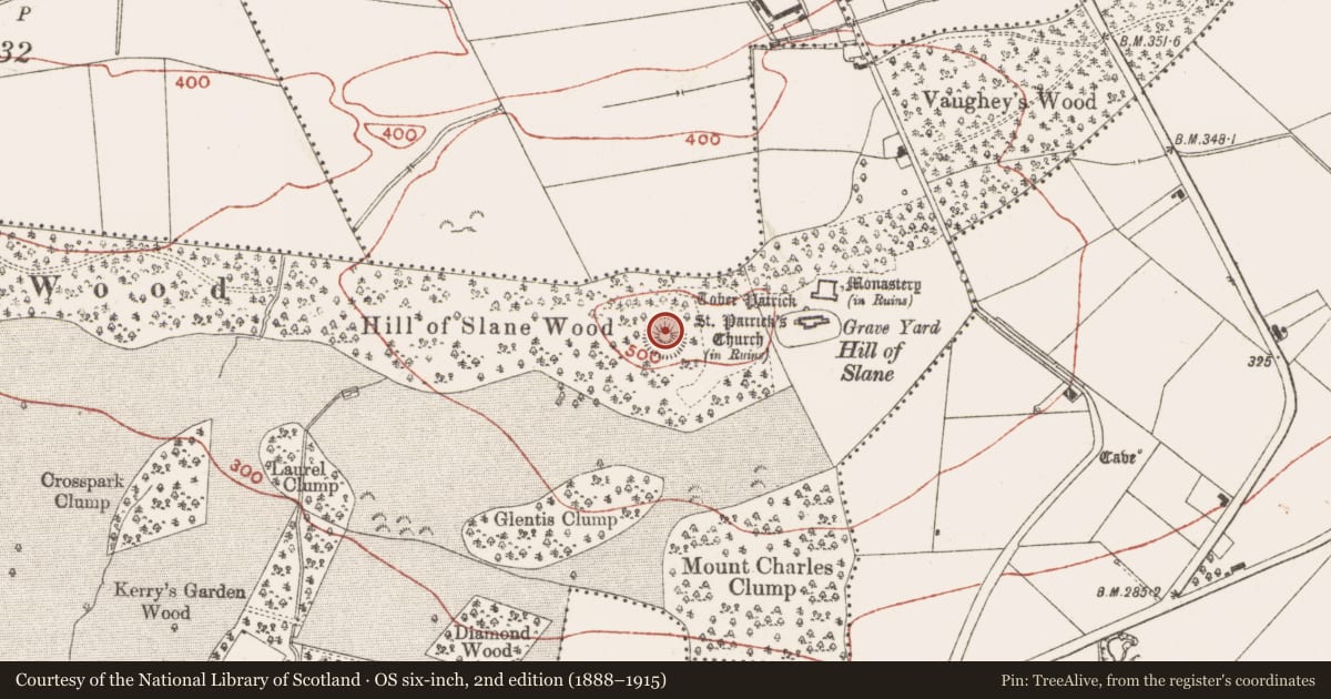
Located at the summit of the Hill of Slane. The motte (ME019-060001-) is separated by a berm (Wth c. 30m) from a large outer enclosure (ext. diam. c. 120m) which is defined by an earthen bank (at SE: Wth of base 3.8m; int. H 0.45m; ext. H 1.3m) and outer fosse (at SE: Wth of top 1.6m; Wth of base 1m; ext. H 0.4m) that is most visible E-S-NW but is reduced to a low scarp elsewhere. At the SE the bank is built onto the scarp of the earthwork (ME019-016015-) and post-dates it. If the motte originated as a prehistoric barrow, this large enclosure might have fulfilled a ceremonial role in relation to it (Herity 1993, 145-6). (Seaver and Brady 2011)
Compiled by Geraldine Stout
Date of upload : 29 March 12
Amended: 27 January 2021
References
Seaver, M. and Brady, C. 2011 Hill of Slane Archaeology Ireland, Heritage Guide No. 55
Herity, M. 1993 Motes and Mounds at Royal Sites in Ireland: Raith Airthir, Meath. Journal of the Royal Society of Antiquaries of Ireland, 23, 127-51.
Nearby in the register
- Castle - motteunder 1 mi
- Enclosureunder 1 mi
- Earthworkunder 1 mi
- Settlement deserted - medievalunder 1 mi
Other entries of the same register within about three miles of this one, by straight line.