Sites and Monuments Record · Ireland
Graveslab
Fennor (Duleek Lower By.), County Meath, Ireland
The record
- Townland
- Fennor (Duleek Lower By.)
- County
- Meath
- Country
- Ireland
- First-edition OS map
- Not indicated
- Latest-edition OS map
- Not indicated
- Coordinates
- 53.70047, -6.53970
- SMR number
- ME019-035003-
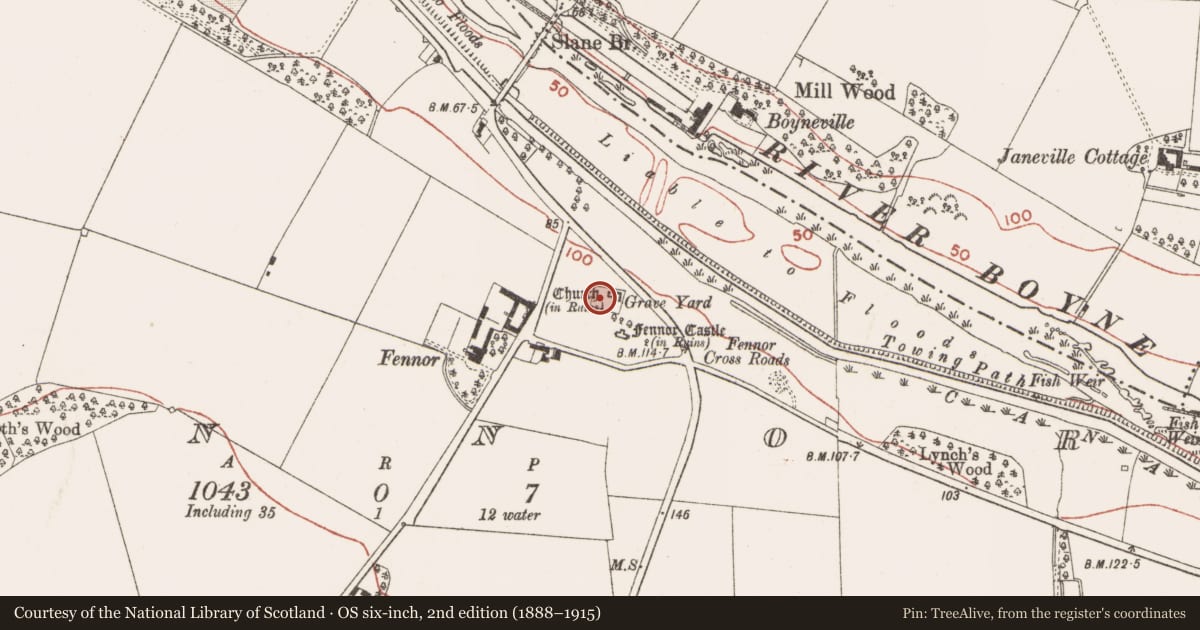
Slide toward Today to fade the historical sheet and see the modern map underneath.
David Rumsey Map Collection, Stanford LibrariesDavid Rumsey Map Collection, Stanford LibrariesDavid Rumsey Map Collection, Stanford LibrariesDavid Rumsey Map Collection, Stanford Libraries
4 historical maps cover this location, the earliest the 1790 map "Composite: Ireland." (David Rumsey Map Collection, Stanford Libraries).
Historical maps covering this location
- 1790 · Composite: Ireland. (David Rumsey Map Collection, Stanford Libraries)
- 1799 · Ireland. (David Rumsey Map Collection, Stanford Libraries)
- 1811 · Ireland. (David Rumsey Map Collection, Stanford Libraries)
- 1891 · Ireland 16 (David Rumsey Map Collection, Stanford Libraries)
This record in the National Monuments Service's Historic Environment Viewer ↗
The National Monuments Service's description
A fragment of a graveslab with the date 1548 is recorded from the graveyard at Fennor (ME019-035001-) but was not noted in 2014. It is described (FitzGerald 1914-15) as:
Near the churchyard gate, being used as a headstone, is the portion of a mullion-like stone, measuring 3 feet in length, 9 half inches wide, and 6 inches in thickness (dims c. 0.9m x c. 0.23m x 0.15m); along the length of one face runs a fragment of an inscription in incised black-letter; the opposite face is smooth and plain, and the sides are grooved. What form this monument took is a puzzle, considering the narrowness of the stone and the fact of its being neatly chiselled on all sides. The missing portions contained the names. What is left of the inscription reads: …DE WILKINSTONE GENEROSI QUA KATHERINA…ILLE QUIDEM ANO DNI 1548 ET 24 MES…. FEBRUARII ILLA VERO
Neither the Fiants nor the Inquisitions give one a clue to the possessors of Wilkinstown about this date.
Compiled by: Michael Moore
Date of upload: 2 September, 2014
References
FitzGerald, Lord W. 1914-15 Fennor Churchyard. Journal of the Association for the Preservation of the Memorials of the Dead in Ireland, 9, 342-3
Nearby in the register
- Graveyardunder 1 mi
- Churchunder 1 mi
- Cross - High crossunder 1 mi
- Castle - tower houseunder 1 mi
Other entries of the same register within about three miles of this one, by straight line.