Sites and Monuments Record · Ireland
Burnt mound
Nugentstown, County Meath, Ireland
The record
- Townland
- Nugentstown
- County
- Meath
- Country
- Ireland
- First-edition OS map
- Not indicated
- Latest-edition OS map
- Not indicated
- Coordinates
- 53.69916, -6.83641
- SMR number
- ME017-093----
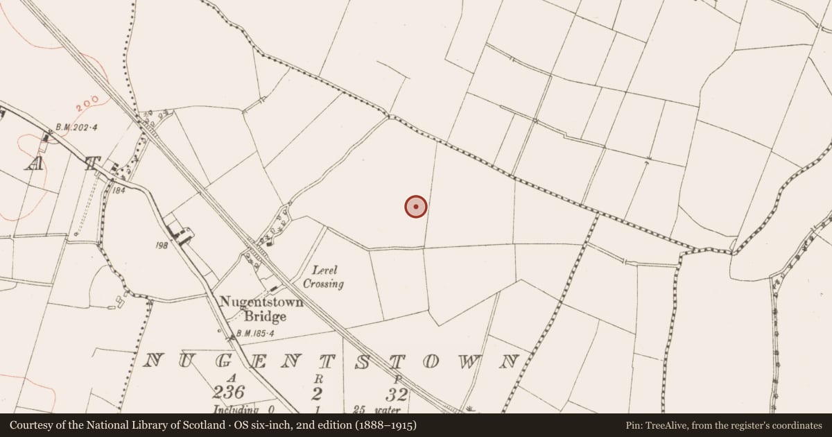
Slide toward Today to fade the historical sheet and see the modern map underneath.
David Rumsey Map Collection, Stanford LibrariesDavid Rumsey Map Collection, Stanford LibrariesDavid Rumsey Map Collection, Stanford LibrariesDavid Rumsey Map Collection, Stanford Libraries
4 historical maps cover this location, the earliest the 1790 map "Composite: Ireland." (David Rumsey Map Collection, Stanford Libraries).
Historical maps covering this location
- 1790 · Composite: Ireland. (David Rumsey Map Collection, Stanford Libraries)
- 1799 · Ireland. (David Rumsey Map Collection, Stanford Libraries)
- 1869 · Ireland. (David Rumsey Map Collection, Stanford Libraries)
- 1891 · Ireland 16 (David Rumsey Map Collection, Stanford Libraries)
This record in the National Monuments Service's Historic Environment Viewer ↗
The National Monuments Service's description
Situated on a level landscape. Archaeological testing (04E0920) by S. Delaney (2005) at Testing Area 7 of Contract 4 of the M3 motorway identified a burnt mound spread (excavations.ie 2004:1171) that was fully excavated (E003135) by P. Lynch (2010) as Nugentstown 2 in January and February 2007 (excavations.ie 2007:1361). An area of just over 1500 square metres was opened and two spreads of broken and burnt stone and a charcoal spread were excavated. The largest spread (dims 8.32m E-W; 4m N-S; D 0.05m) filled a natural hollow in the subsoil. A fragment of alder charcoal from this yielded a C14 date of 2575-2475 cal. BC (UBA 11133), placing it at the Late Neolithic / Early Bronze Age transition. The second spread (dims 2.5m E-W; 1.3m N-S; D 0.08m) c. 10m to the N was also lodged in a hollow on the surface of the subsoil. A small spread (dims 1.5m x 1.3m; T 0.02m) of charcoal was c. 17m NW of the larger spread of heat-affected stone. Al the material is probably dislodged from its original location. (Lynch 2010, 5-6)
Compiled by: Michael Moore
Date of upload: 23 March 2022
References
Lynch, P. 2010 M3 Clonee – North of Kells, Contract 4, Navan to Kells and Kells Bypass. Final Report on Nugentstown 2, Co. Meath. Licence: E003135. Unpublished report, Irish Archaeological Consultancy
Delaney, S. 2005 M3 Clonee-North of Kells; Contract 4, Navan - Kells and Kells Bypass. Report on Archaeological Assessment at Testing Area 7 in Athgaine Little and Nugentstown, County Meath. Licence: 04E0920. Unpublished report, Irish Archaeological Consultancy
Nearby in the register
- Burnt moundunder 1 mi
- Hut siteunder 1 mi
- House - prehistoricunder 1 mi
- Excavation - miscellaneousunder 1 mi
Other entries of the same register within about three miles of this one, by straight line.