Sites and Monuments Record · Ireland
Kiln - corn-drying
Castlekeeran, County Meath, Ireland
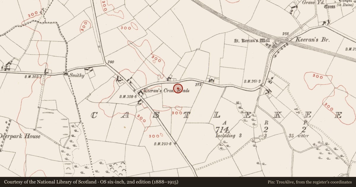
The record
- Townland
- Castlekeeran
- County
- Meath
- Country
- Ireland
- First-edition OS map
- Not indicated
- Latest-edition OS map
- Not indicated
- Coordinates
- 53.73702, -6.96540
- SMR number
- ME016-068----
Slide toward Today to fade the historical sheet and see the modern map underneath.
David Rumsey Map Collection, Stanford LibrariesDavid Rumsey Map Collection, Stanford LibrariesDavid Rumsey Map Collection, Stanford LibrariesDavid Rumsey Map Collection, Stanford Libraries
4 historical maps cover this location, the earliest the 1636 map "Vltoniae Orientalis Pars" (David Rumsey Map Collection, Stanford Libraries).
Historical maps covering this location
- 1636 · Vltoniae Orientalis Pars (David Rumsey Map Collection, Stanford Libraries)
- 1790 · Composite: Ireland. (David Rumsey Map Collection, Stanford Libraries)
- 1869 · Ireland. (David Rumsey Map Collection, Stanford Libraries)
- 1891 · Ireland 16 (David Rumsey Map Collection, Stanford Libraries)
This record in the National Monuments Service's Historic Environment Viewer ↗
The National Monuments Service's description
Situated on a rise in a gently undulating landscape. Archaeological testing (04E1056) by G. McLoughlin (2005) at Test Area 5 of Contract 5 of the M3 identified pits (excavations.ie 2004:1200) that were fully excavated (E003178) by S. Reilly in January 2007 (excavations.ie 2007:1276) as Castlekeeran 1. This is a small keyhole-shaped corn-drying kiln (dims 2.3m x 1.5m; max. D 0.74m) with evidence of a lining of small stones set in the fill of an earlier usage that contained some cremated bone together with evidence of barley, wheat, rye and oats. The stone-lined kiln had three fills and evidence of the same mix of cereals. A sample of willow charcoal from its lowest fill produced a C14 date of 392-562 cal. AD (Beta 247180). A circular pit (diam. 3m; max. D 0.76m) with seven fills was 8m to the SW and had three fills including cremated bone and animal bone as well as cereal grains. (Reilly and Ginn 2008)
Compiled by: Michael Moore
Date of upload: 4 March 2022
References
McLoughlin, G. 2005 M3 Clonee-North of Kells; Contract 5, Kells to North of Kells. Report on Archaeological Assessment at Testing Area 9 in Castlekeeran, County Meath. Licence: 04E1056. Unpublished report, Irish Archaeological Consultancy
Reilly, S. and V. Ginn 2008 M3 Clonee-North of Kells; Contract 5, Kells to North of Kells. Final Report on the Archaeological Excavation of Castlekeeran 1, Co. Meath. Licence: E003178. Unpublished report, Archaeological Consultancy Services
Nearby in the register
- Excavation - miscellaneousunder 1 mi
- Ritual site - holy wellunder 1 mi
- Cross - High crossunder 1 mi
- Graveyardunder 1 mi
Other entries of the same register within about three miles of this one, by straight line.