Sites and Monuments Record · Ireland
Ringfort - rath
Drumsawry Or Summerbank, County Meath, Ireland
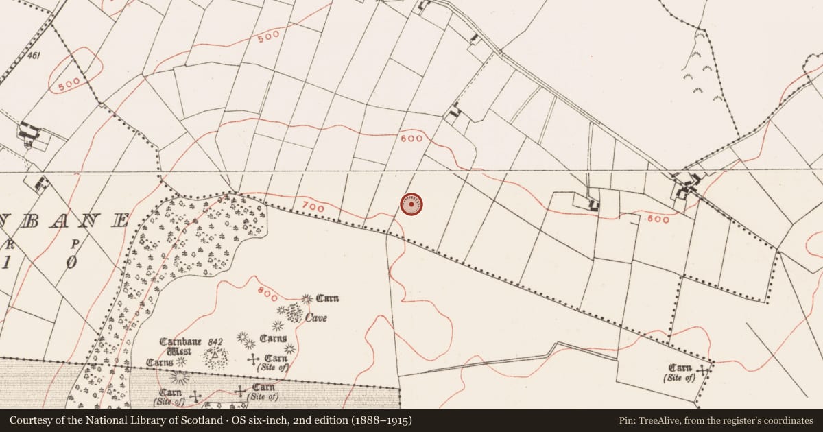
The record
- Townland
- Drumsawry Or Summerbank
- County
- Meath
- Country
- Ireland
- First-edition OS map
- Fort
- Latest-edition OS map
- Hachured
- Coordinates
- 53.74528, -7.13022
- SMR number
- ME015-004----
Slide toward Today to fade the historical sheet and see the modern map underneath.
David Rumsey Map Collection, Stanford LibrariesDavid Rumsey Map Collection, Stanford LibrariesDavid Rumsey Map Collection, Stanford LibrariesDavid Rumsey Map Collection, Stanford Libraries
4 historical maps cover this location, the earliest the 1636 map "Vltoniae Orientalis Pars" (David Rumsey Map Collection, Stanford Libraries).
Historical maps covering this location
- 1636 · Vltoniae Orientalis Pars (David Rumsey Map Collection, Stanford Libraries)
- 1790 · Composite: Ireland. (David Rumsey Map Collection, Stanford Libraries)
- 1869 · Ireland. (David Rumsey Map Collection, Stanford Libraries)
- 1891 · Ireland 16 (David Rumsey Map Collection, Stanford Libraries)
This record in the National Monuments Service's Historic Environment Viewer ↗
The National Monuments Service's description
Located towards the top of the N-facing slope of Carnbane West hill. This is a circular grass-covered area (diam. 30m NE-SW; 27m NW-SE) defined by an earthen bank (Wth of base 5-6m; int. H 0.2m at ENE to 1.2m at WSW), and an outer, rounded fosse that is best preserved (at WSW: Wth of top 5m; ext. D 1m) SE-WNW but its outer edge is clipped by a N-S field bank W-NW and it is largely reduced to a berm N-E. The entrance (Wth of base 1.1m) and a slight causeway (Wth 5.7m; H 0.25m) are at SSE. Archaeological testing (15E0276) by R. Meenan c. 200m to the NNE produced no related material (excavations.ie 2015:365).
The above description is derived from the published 'Archaeological Inventory of County Meath' (Dublin: Stationery Office, 1987). In certain instances the entries have been revised and updated in the light of recent research.
Compiled by: Michael Moore
Date of revision: 8 January 2019
Amended: 9 April 2021
Nearby in the register
- Megalithic tomb - passage tombunder 1 mi
- Megalithic tomb - passage tombunder 1 mi
- Megalithic tomb - passage tombunder 1 mi
- Megalithic tomb - passage tombunder 1 mi
Other entries of the same register within about three miles of this one, by straight line.