Sites and Monuments Record · Ireland
Mound
Donore (Kells Lower By.), County Meath, Ireland
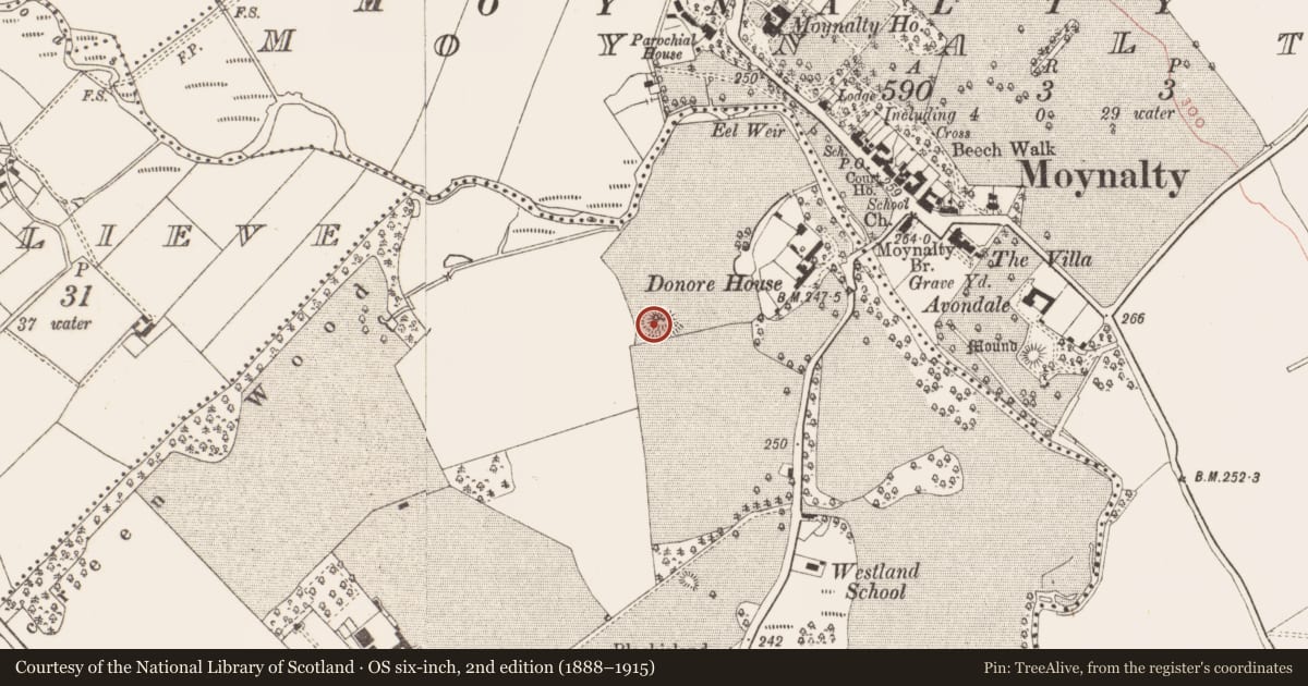
The record
- Townland
- Donore (Kells Lower By.)
- County
- Meath
- Country
- Ireland
- First-edition OS map
- Indicated
- Latest-edition OS map
- Hachured
- Coordinates
- 53.78775, -6.89133
- SMR number
- ME011-011----
Slide toward Today to fade the historical sheet and see the modern map underneath.
David Rumsey Map Collection, Stanford LibrariesDavid Rumsey Map Collection, Stanford LibrariesDavid Rumsey Map Collection, Stanford LibrariesDavid Rumsey Map Collection, Stanford Libraries
4 historical maps cover this location, the earliest the 1636 map "Vltoniae Orientalis Pars" (David Rumsey Map Collection, Stanford Libraries).
Historical maps covering this location
- 1636 · Vltoniae Orientalis Pars (David Rumsey Map Collection, Stanford Libraries)
- 1790 · Composite: Ireland. (David Rumsey Map Collection, Stanford Libraries)
- 1869 · Ireland. (David Rumsey Map Collection, Stanford Libraries)
- 1891 · Ireland 16 (David Rumsey Map Collection, Stanford Libraries)
This record in the National Monuments Service's Historic Environment Viewer ↗
The National Monuments Service's description
Situated on a hillock in the valley of the meandering NW-SE Owenroe or Moynalty River, with the stream c. 120m to the N. The Moynalty hoard, consisting of nine pieces of eight-century AD metalwork, including a highly ornate door-handle probably from a church, was found c. 250m to the N beside the river (Ryan 1987). The mound would have been in full view of Donore House c. 170m to the E before farm sheds intervened. This is a flat-topped grass-covered mound (diam. of top 10.5m E-W; 10m N-S) defined by a scarp (at SE: H 2.5m) and planted with deciduous trees. The base is surrounded by a quarry and outer bank ENE-S-SW. The E half of the mound has been removed and only a small portion of the outer bank survives at S (Roycroft 2018, 3-4, Fig. 21). Archaeological testing (01E1196) by B. Shanahan of a limited area (c. 0.3 ha) c. 50m to the E at the closest point produced no archaeological material (excavations.ie 2001:1014).
The above description is derived from the published 'Archaeological Inventory of County Meath' (Dublin: Stationery Office, 1987). In certain instances the entries have been revised and updated in the light of recent research.
Compiled by: Michael Moore
Date of revision: 9 April 2019
Amended: 14 October 2025
References
Roycroft, N. 2018 Moynalty Steam Threshing Museum: Threshing field lighting project, Co. Meath. Unpublished desk- based assessment. Author, 2018 Ryan, R. 1987 The Donore Hoard: Early Medieval Metalwork from Moynalty, near Kells, Ireland, Antiquity 61, 57-63.
Nearby in the register
- Bridgeunder 1 mi
- Water mill - unclassifiedunder 1 mi
- Kiln - corn-dryingunder 1 mi
- Graveyardunder 1 mi
Other entries of the same register within about three miles of this one, by straight line.