Sites and Monuments Record · Ireland
Graveyard
Páirc An Teampaill Íochtarach, County Mayo, Ireland
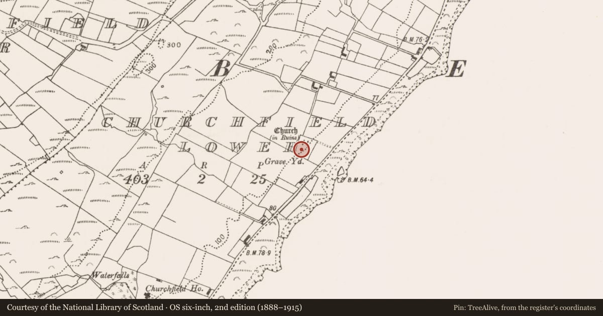
The record
- Townland
- Páirc An Teampaill Íochtarach
- County
- Mayo
- Country
- Ireland
- First-edition OS map
- Grave Yd.
- Latest-edition OS map
- Grave Yard
- Coordinates
- 53.62885, -9.39030
- SMR number
- MA117-009002-
Slide toward Today to fade the historical sheet and see the modern map underneath.
David Rumsey Map Collection, Stanford LibrariesDavid Rumsey Map Collection, Stanford LibrariesDavid Rumsey Map Collection, Stanford LibrariesDavid Rumsey Map Collection, Stanford Libraries
4 historical maps cover this location, the earliest the 1753 map "Mappa geographica Regni Hiberniae" (David Rumsey Map Collection, Stanford Libraries).
Historical maps covering this location
- 1753 · Mappa geographica Regni Hiberniae (David Rumsey Map Collection, Stanford Libraries)
- 1790 · Composite: Ireland. (David Rumsey Map Collection, Stanford Libraries)
- 1869 · Ireland. (David Rumsey Map Collection, Stanford Libraries)
- 1891 · Ireland 16 (David Rumsey Map Collection, Stanford Libraries)
This record in the National Monuments Service's Historic Environment Viewer ↗
The National Monuments Service's description
Located on the W shores of Lough Mask. This graveyard is shown on the 1838 OS 6-inch map as a trapezoidal walled area (c. 35M N−S; c. 40m E−W at N end, c. 20m at S end) with a church (MA117-009001-) indicated in the N half; on the 1929 edition it is shown as a somewhat larger, rectangular walled area (48m E−W; 57m N−S). The W, N and E walls are stone-built, with stone and mortar coping. The S wall of the graveyard has been removed and the graveyard extended to S and SE. The interior is grass-covered. There are 19th and 20th−century headstones, occasional graveslabs, and rectangular graveplots with concrete surrounds. The graveyard underwent a ‘clean-up’ in the second half of the in the 20th-century; there are multiple N−S rows of low, plain concrete crosses, which appear to have replaced traditional uninscribed, stone gravemarkers, a few of which are extant at the site of the church (MA117-009001-). There is a bullaun stone (MA117-009003-) in the grave yard.
Image: MA117-009002-_01.JPG viewed from NW
Compiled by: Jane O'Shaughnessy
Date of upload: 24 July 2017
Nearby in the register
- Churchunder 1 mi
- Bullaun stoneunder 1 mi
- Moundunder 1 mi
- Crannogunder 1 mi
Other entries of the same register within about three miles of this one, by straight line.