Sites and Monuments Record · Ireland
Ritual site - holy well
Holywell Lower, County Mayo, Ireland
The record
- Townland
- Holywell Lower
- County
- Mayo
- Country
- Ireland
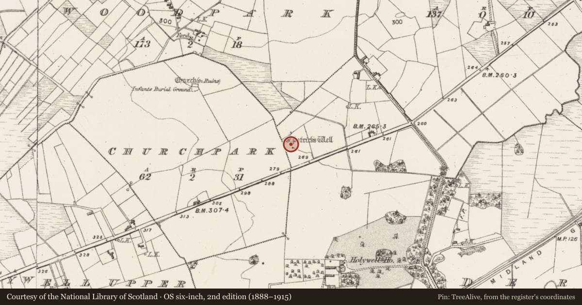
- First-edition OS map
- St. Patricks Well
- Latest-edition OS map
- St. Patricks Well
- Coordinates
- 53.74654, -8.80338
- SMR number
- MA103-003002-
Slide toward Today to fade the historical sheet and see the modern map underneath.
David Rumsey Map Collection, Stanford LibrariesDavid Rumsey Map Collection, Stanford LibrariesDavid Rumsey Map Collection, Stanford LibrariesDavid Rumsey Map Collection, Stanford Libraries
4 historical maps cover this location, the earliest the 1753 map "Mappa geographica Regni Hiberniae" (David Rumsey Map Collection, Stanford Libraries).
Historical maps covering this location
- 1753 · Mappa geographica Regni Hiberniae (David Rumsey Map Collection, Stanford Libraries)
- 1790 · Composite: Ireland. (David Rumsey Map Collection, Stanford Libraries)
- 1869 · Ireland. (David Rumsey Map Collection, Stanford Libraries)
- 1891 · Ireland 16 (David Rumsey Map Collection, Stanford Libraries)
This record in the National Monuments Service's Historic Environment Viewer ↗
The National Monuments Service's description
In pasture, in a slight hollow enclosed at W and N by gently rising ground.
A natural spring well gathering in a small pool (max. dim. c. 2m; D 0.2m), with an outflow stream flowing to SE where it is channelled into a modern field drain. The head of the spring at the N edge of the pool is now enclosed by a concrete pipe. Curving around the N side of the spring is a low stony rise set in the top of which is a small stone cross (MA103-003003-). An ash tree stands at the W end of the rise, on the NW side of the spring.
Named ‘St. Patrick’s Well’ on the 1838 and 1916 OS 6-inch maps, a pattern or prayer cycle was traditionally held here each year on the first Sunday in August. ‘St. Patrick’s Church (Site of)’ (MA103-003001-) is indicated immediately to W of the well on the 1916 OS 6-inch map, but no remains are now visible. Another church (MA102-002001-), a graveyard (MA103-002002-) and a children’s burial ground (MA103-002003-) are located 300m to NW.
Compiled by: Jane O’Shaughnessy
Date of upload: 4 October 2022
Nearby in the register
- Churchunder 1 mi
- Crossunder 1 mi
- Fontunder 1 mi
- Children's burial groundunder 1 mi
Other entries of the same register within about three miles of this one, by straight line.