Sites and Monuments Record · Ireland
Road - road/trackway
Pollawaddy (Carra By.),Derrynacannana,Luffertaun, County Mayo, Ireland
The record
- Townland
- Pollawaddy (Carra By.),Derrynacannana,Luffertaun
- County
- Mayo
- Country
- Ireland
- First-edition OS map
- Togher Patrick
- Latest-edition OS map
- Togher Patrick
- Coordinates
- 53.76288, -9.31951
- SMR number
- MA089-046----
Slide toward Today to fade the historical sheet and see the modern map underneath.
David Rumsey Map Collection, Stanford LibrariesDavid Rumsey Map Collection, Stanford LibrariesDavid Rumsey Map Collection, Stanford LibrariesDavid Rumsey Map Collection, Stanford Libraries
4 historical maps cover this location, the earliest the 1753 map "Mappa geographica Regni Hiberniae" (David Rumsey Map Collection, Stanford Libraries).
Historical maps covering this location
- 1753 · Mappa geographica Regni Hiberniae (David Rumsey Map Collection, Stanford Libraries)
- 1790 · Composite: Ireland. (David Rumsey Map Collection, Stanford Libraries)
- 1869 · Ireland. (David Rumsey Map Collection, Stanford Libraries)
- 1891 · Ireland 16 (David Rumsey Map Collection, Stanford Libraries)
This record in the National Monuments Service's Historic Environment Viewer ↗
The National Monuments Service's description
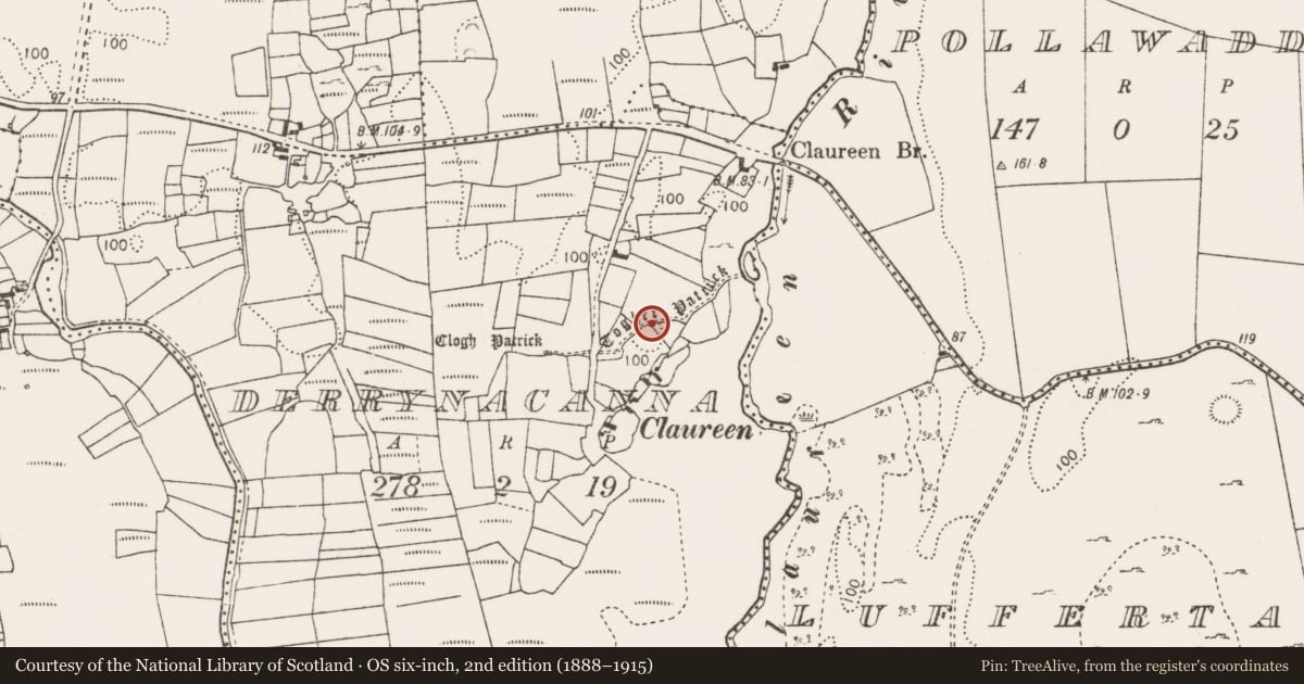
This record refers to a discrete section of the tradition pilgrimage route known as Togher Patrick, which is shown on the 1839 and 1930 OS 6-inch map. This section of the route is depicted on the maps as a dashed line, coinciding in parts with field boundaries; it has a roughly E-W orientation, reflecting the overall trajectory of the route from Ballintubber Abbey (MA089-058001-) toward its destination on the summit of Croagh Patrick. On the 1839 map this portion of the route is marked for a distance of c. 500m, but on the later edition the E part of this (c. 250m) is no longer shown. On both editions the W end of the dashed line representing the route ends at a standing stone (MA089-045----), known as ‘Clogh Patrick’, which appears to have served as a significant waymark. There are no visible remains of a built trackway or road.
Compiled by: Jane O'Shaughnessy
Date of upload: 10 April 2018
Nearby in the register
- Ritual site - holy/saint's stoneunder 1 mi
- Castle - unclassifiedunder 1 mi
- Enclosureunder 1 mi
- Earthworkunder 1 mi
Other entries of the same register within about three miles of this one, by straight line.