Sites and Monuments Record · Ireland
Ringfort - rath
Mountaincommon, County Mayo, Ireland
The record
- Townland
- Mountaincommon
- County
- Mayo
- Country
- Ireland
- First-edition OS map
- Indicated
- Latest-edition OS map
- Hachured
- Coordinates
- 53.81815, -8.80721
- SMR number
- MA082-024----
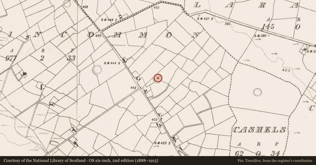
Slide toward Today to fade the historical sheet and see the modern map underneath.
David Rumsey Map Collection, Stanford LibrariesDavid Rumsey Map Collection, Stanford LibrariesDavid Rumsey Map Collection, Stanford LibrariesDavid Rumsey Map Collection, Stanford Libraries
4 historical maps cover this location, the earliest the 1753 map "Mappa geographica Regni Hiberniae" (David Rumsey Map Collection, Stanford Libraries).
Historical maps covering this location
- 1753 · Mappa geographica Regni Hiberniae (David Rumsey Map Collection, Stanford Libraries)
- 1790 · Composite: Ireland. (David Rumsey Map Collection, Stanford Libraries)
- 1869 · Ireland. (David Rumsey Map Collection, Stanford Libraries)
- 1891 · Ireland 16 (David Rumsey Map Collection, Stanford Libraries)
This record in the National Monuments Service's Historic Environment Viewer ↗
The National Monuments Service's description
In pasture, located on a slight rise.
Slightly raised circular (30m N–S;31m E–W) defined by a low bank (Wth 2-2.5m; int. H 0.2-0.3m; ext. H 0.7-0.8m) of earth and stone, and enclosed at S–WNW by a fosse (Wth 3m) and external bank (Wth 2.4m; int. H 0.6m; ext. H 0.7m). Both banks appear to be largely earthen in construction, but incorporate stones in parts, with a scattering of stones, mostly field clearance, along the top. The outer bank has been levelled at E–S, but a slight surface undulation can still be discerned. The fosse, which is silted up, appears shallow and narrow, and is filled with field clearance debris in parts. A break (Wth 3m) in the inner bank at ESE may indicate the original entrance. The W half of the interior is at a slightly higher level that the E half.
Interior is largely grassy but scattered with hawthorn bushes; hawthorn and blackthorn cover both enclosing banks. There is a rath (MA082-023----) 260m to WNW and another (MA082-025----) 145m to E.
Compiled by: Jane O'Shaughnessy
Date of upload: 2 February 2018
Nearby in the register
- Ringfort - rathunder 1 mi
- Ringfort - rathunder 1 mi
- Ringfort - rathunder 1 mi
- Ringfort - cashelunder 1 mi
Other entries of the same register within about three miles of this one, by straight line.