Sites and Monuments Record · Ireland
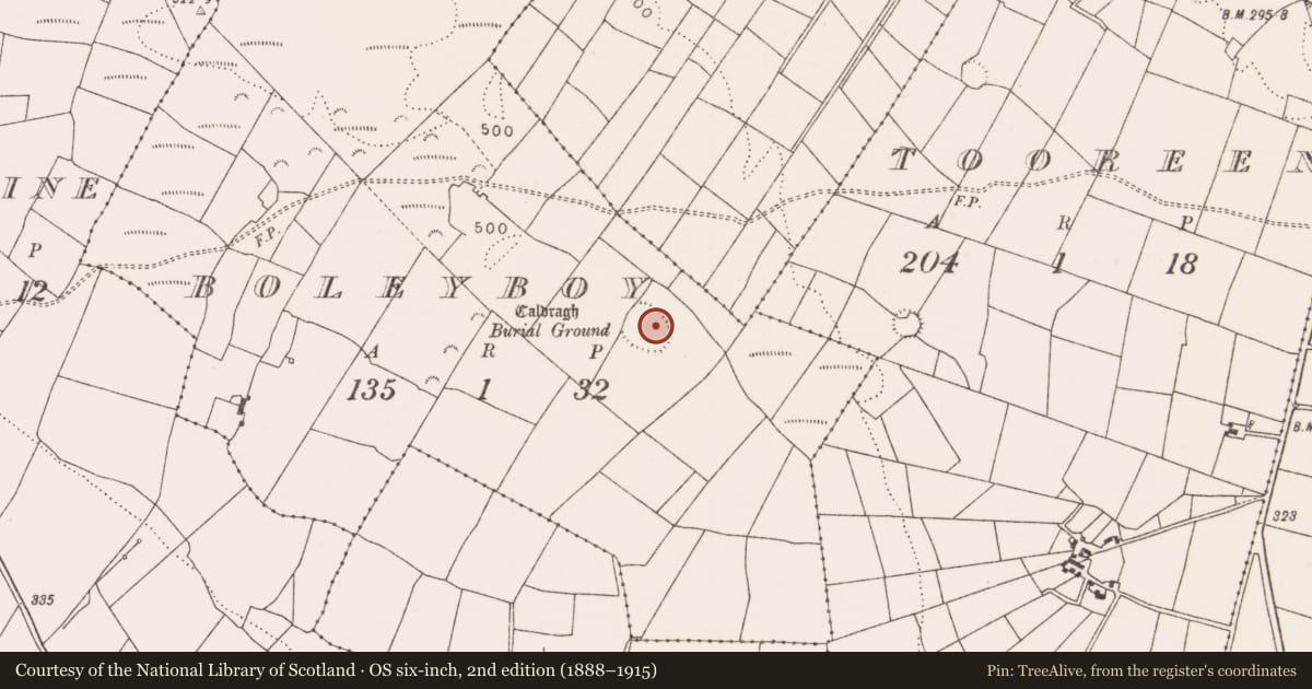
Ringfort - cashel
Boleyboy (Costello By.), County Mayo, Ireland
The record
- Townland
- Boleyboy (Costello By.)
- County
- Mayo
- Country
- Ireland
- First-edition OS map
- Indicated
- Latest-edition OS map
- Hachured
- Coordinates
- 53.83107, -8.77702
- SMR number
- MA082-016001-
Slide toward Today to fade the historical sheet and see the modern map underneath.
David Rumsey Map Collection, Stanford LibrariesDavid Rumsey Map Collection, Stanford LibrariesDavid Rumsey Map Collection, Stanford LibrariesDavid Rumsey Map Collection, Stanford Libraries
4 historical maps cover this location, the earliest the 1790 map "Composite: Ireland." (David Rumsey Map Collection, Stanford Libraries).
Historical maps covering this location
- 1790 · Composite: Ireland. (David Rumsey Map Collection, Stanford Libraries)
- 1857 · Ireland (David Rumsey Map Collection, Stanford Libraries)
- 1869 · Ireland. (David Rumsey Map Collection, Stanford Libraries)
- 1891 · Ireland 16 (David Rumsey Map Collection, Stanford Libraries)
This record in the National Monuments Service's Historic Environment Viewer ↗
The National Monuments Service's description
In pasture, located close to the break of slope on the NE side of a broad plateau on a NW–SE ridge, There are excellent views to W–NW along the top of the ridge, and eastwards over a panoramic sweep of countryside.
An oval area (45m NE–SW; 58.4m NW–SE) defined at WSW–NW by a low scarp incorporated into a later field wall, at N–ENE by a barely discernible levelled scarp and at ENE–SE by sod-covered wall footings (Wth 2m; ext. H 0.4m). At SSE–SW the enclosing element has been entirely levelled, although an ephemeral undulation can be traced in parts. To NW, at a distance of 3-3.5m outside the enclosing scarp, there is a slight rise which curves to NNE where it merges with the natural contours of the ridge slope. It is not clear if this is merely a natural undulation or an indication of an outer enclosing bank or wall.
The grass-covered interior is fairly level. It was used as a children’s burial ground (MA082-016002-) focused on a roughly square area (c. 19m NE–SW; c. 19m NW–SE) in the SE sector.
Compiled by: Jane O’Shaughnessy
Date of upload: 20 December 2021
Nearby in the register
- Children's burial groundunder 1 mi
- Structureunder 1 mi
- Enclosureunder 1 mi
- Souterrainunder 1 mi
Other entries of the same register within about three miles of this one, by straight line.