Sites and Monuments Record · Ireland
Ringfort - rath
Carrownageeragh (Gallen By., Killeden Par.), County Mayo, Ireland
The record
- Townland
- Carrownageeragh (Gallen By., Killeden Par.)
- County
- Mayo
- Country
- Ireland
- Latest-edition OS map
- Hachured
- Coordinates
- 53.83138, -9.02662
- SMR number
- MA080-040----
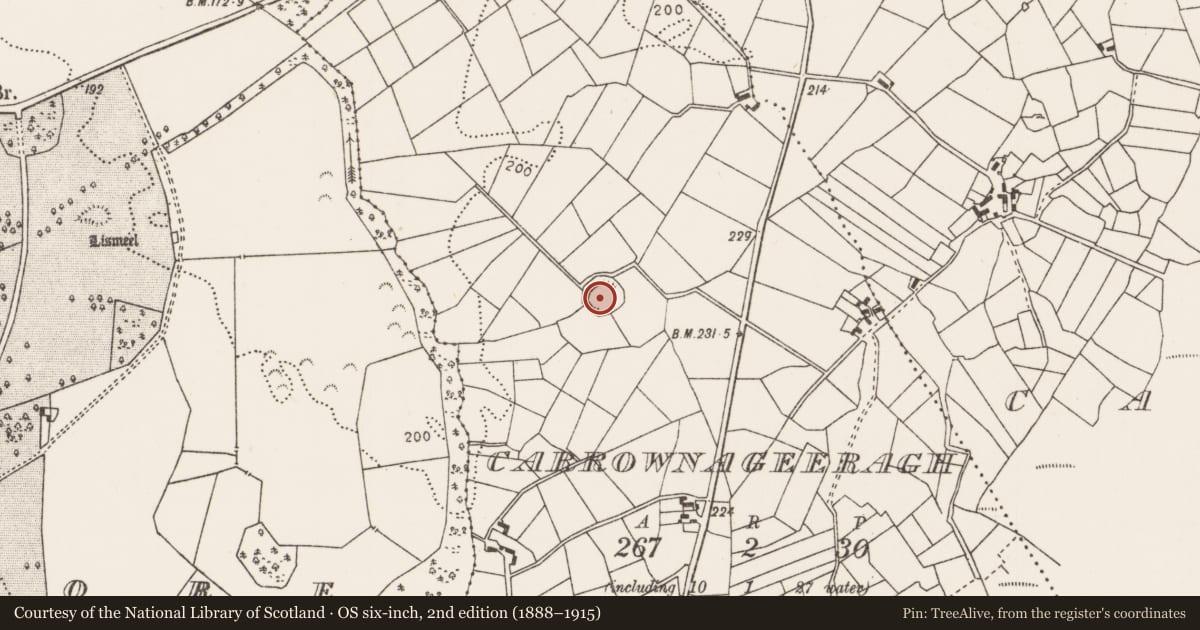
Slide toward Today to fade the historical sheet and see the modern map underneath.
David Rumsey Map Collection, Stanford LibrariesDavid Rumsey Map Collection, Stanford LibrariesDavid Rumsey Map Collection, Stanford LibrariesDavid Rumsey Map Collection, Stanford Libraries
4 historical maps cover this location, the earliest the 1753 map "Mappa geographica Regni Hiberniae" (David Rumsey Map Collection, Stanford Libraries).
Historical maps covering this location
- 1753 · Mappa geographica Regni Hiberniae (David Rumsey Map Collection, Stanford Libraries)
- 1790 · Composite: Ireland. (David Rumsey Map Collection, Stanford Libraries)
- 1869 · Ireland. (David Rumsey Map Collection, Stanford Libraries)
- 1891 · Ireland 16 (David Rumsey Map Collection, Stanford Libraries)
This record in the National Monuments Service's Historic Environment Viewer ↗
The National Monuments Service's description
In pasture, straddling the break of slope at the top of a W-facing slope. There is a stream at the base of the slope c. 200m to W.
Circular area (c. 38m NNE-SSW; c. 36m WNW-ESE) defined SSW−N−NNE by a substantial earthen scarp (H 3.4m), topped with slight remnants of stone walling, probably a later field wall. The scarp peters out at NE−E and is entirely levelled and flush with exterior field level at E−S.
Outside the scarp at SSE−NNE is a broad terrace/fosse (Wth 5.5m) with an external earth and stone bank (H 1m). The external bank serves as a field fence and is topped with a post and wire fence and hazel and thorn bushes; it takes the form of a scarp topped with tumbled stone walling at W−NW, at NW-N it is bordered by a farm track that skirts the N side of the enclosure, and it has been levelled at NNE−SE to a slight surface undulation. The interior of the enclosure is level and featureless.
Compiled by: Jane O’Shaughnessy
Date of upload: 3 December 2021
Nearby in the register
- Burnt moundunder 1 mi
- Burnt moundunder 1 mi
- Ringfort - unclassifiedunder 1 mi
- Ringfort - rathunder 1 mi
Other entries of the same register within about three miles of this one, by straight line.