Sites and Monuments Record · Ireland
Ringfort - rath
Ballinlag, County Mayo, Ireland
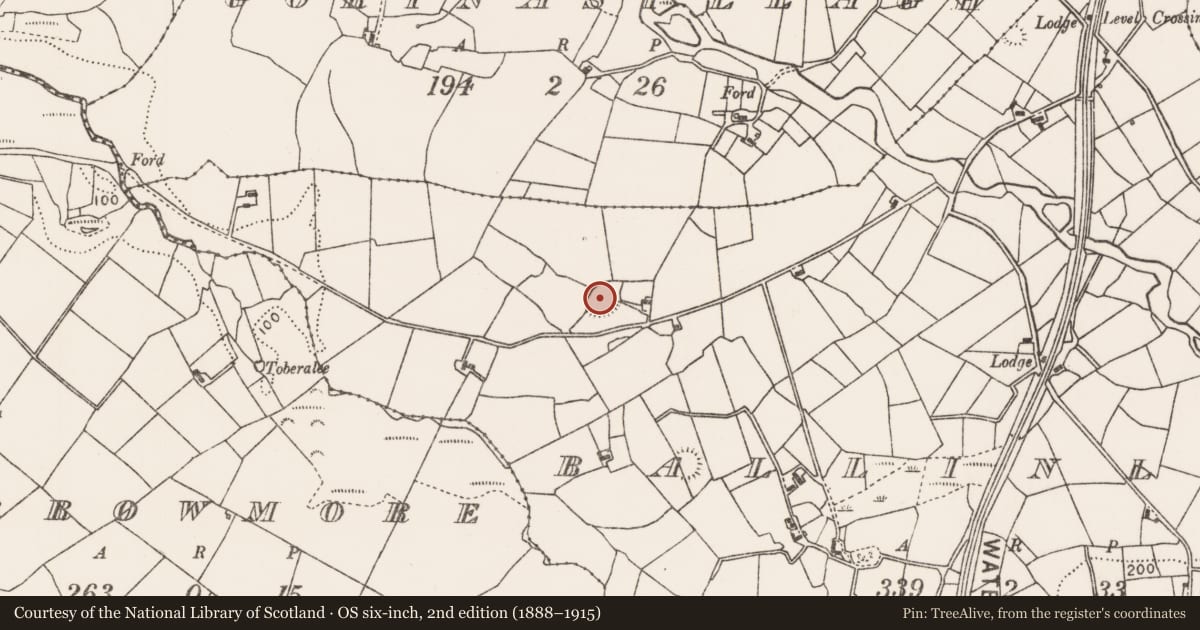
The record
- Townland
- Ballinlag
- County
- Mayo
- Country
- Ireland
- First-edition OS map
- Indicated
- Latest-edition OS map
- Hachured
- Coordinates
- 53.90275, -9.00554
- SMR number
- MA071-097----
Slide toward Today to fade the historical sheet and see the modern map underneath.
David Rumsey Map Collection, Stanford LibrariesDavid Rumsey Map Collection, Stanford LibrariesDavid Rumsey Map Collection, Stanford LibrariesDavid Rumsey Map Collection, Stanford Libraries
4 historical maps cover this location, the earliest the 1753 map "Mappa geographica Regni Hiberniae" (David Rumsey Map Collection, Stanford Libraries).
Historical maps covering this location
- 1753 · Mappa geographica Regni Hiberniae (David Rumsey Map Collection, Stanford Libraries)
- 1790 · Composite: Ireland. (David Rumsey Map Collection, Stanford Libraries)
- 1869 · Ireland. (David Rumsey Map Collection, Stanford Libraries)
- 1891 · Ireland 16 (David Rumsey Map Collection, Stanford Libraries)
This record in the National Monuments Service's Historic Environment Viewer ↗
The National Monuments Service's description
In pasture, located on top of a ridge, which provides extensive views, except to NW where ground rises.
Oval area (c. 49m NE−SW; 36.5m NW−SE) defined by an earth and stone bank (Wth 3m; int. H 0.6m; ext. H 1.3m, at SSE). The bank has been adapted to serve as a field boundary at SW−N where it is faced externally with stone. There is a break (Wth 2.6m) in the bank at NW and another break (Wth 3.4m) at SSW.
The interior has a gentle slope down from NW to S−SE; it is grassy, with a somewhat uneven, hummocky surface. Slight remnants of a NW−SE linear feature (possibly remnants of a wall/field fence) extend from the enclosing stone bank at SE across the interior towards the centre to NW, petering out at an overgrowth-covered heap of field clearance stones. A deep pit (diam. c. 8m; D 2m) has been quarried into the enclosing bank and the adjoining part of the interior at NW; the pit is partly infilled with field clearance debris. A slightly larger pit is located immediately outside the rath at NE. The rath bank is engulfed in overgrowth.
Compiled by: Jane O’Shaughnessy
Date of upload: 17 August 2021
Nearby in the register
- Ringfort - rathunder 1 mi
- Ringfort - rathunder 1 mi
- Barrow - ring-barrowunder 1 mi
- Ringfort - rathunder 1 mi
Other entries of the same register within about three miles of this one, by straight line.