Sites and Monuments Record · Ireland
Monumental structure
Carrownacross (Gallen By., Kildacommoge Par.), County Mayo, Ireland
The record
- Townland
- Carrownacross (Gallen By., Kildacommoge Par.)
- County
- Mayo
- Country
- Ireland
- First-edition OS map
- Monuments
- Latest-edition OS map
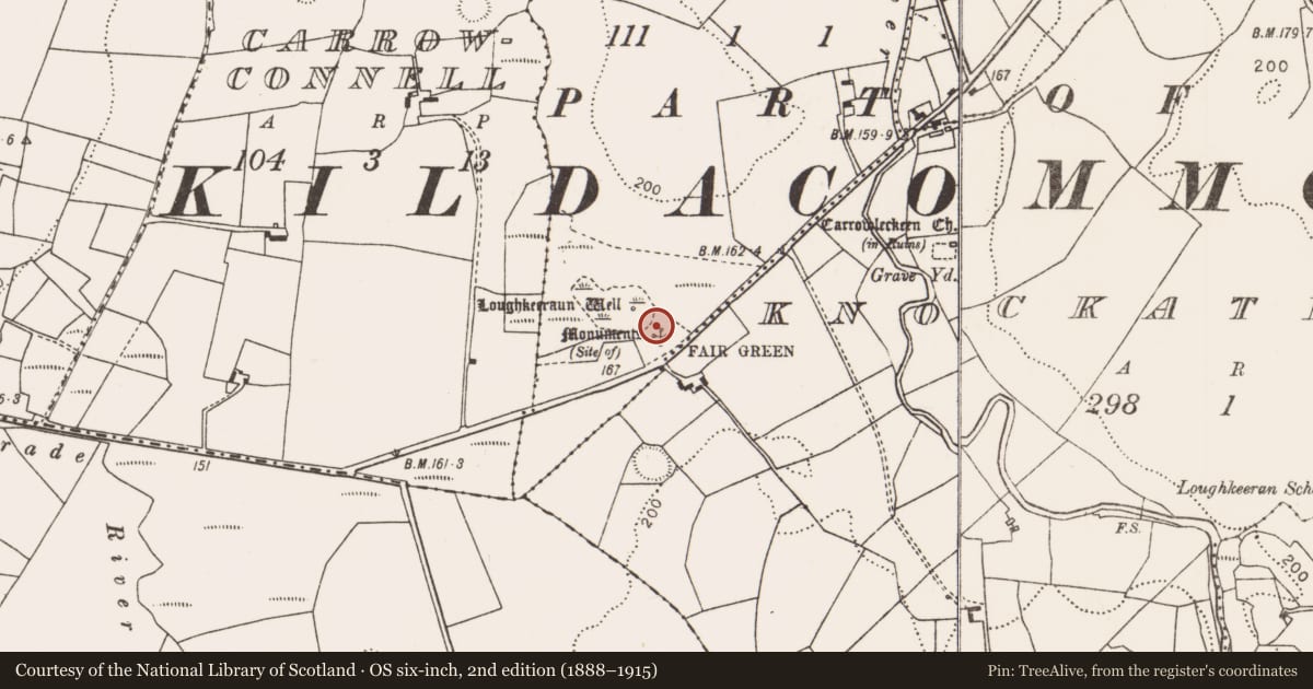
- Monuments (Site of)
- Coordinates
- 53.89061, -9.11562
- SMR number
- MA070-166005-
Slide toward Today to fade the historical sheet and see the modern map underneath.
David Rumsey Map Collection, Stanford LibrariesDavid Rumsey Map Collection, Stanford LibrariesDavid Rumsey Map Collection, Stanford LibrariesDavid Rumsey Map Collection, Stanford Libraries
4 historical maps cover this location, the earliest the 1753 map "Mappa geographica Regni Hiberniae" (David Rumsey Map Collection, Stanford Libraries).
Historical maps covering this location
- 1753 · Mappa geographica Regni Hiberniae (David Rumsey Map Collection, Stanford Libraries)
- 1790 · Composite: Ireland. (David Rumsey Map Collection, Stanford Libraries)
- 1869 · Ireland. (David Rumsey Map Collection, Stanford Libraries)
- 1891 · Ireland 16 (David Rumsey Map Collection, Stanford Libraries)
This record in the National Monuments Service's Historic Environment Viewer ↗
The National Monuments Service's description
This is one of three small upright features (MA070-166003-; MA070-166004-; MA070-166005-), named ‘Monuments’, which are shown to E of Loughkeeran holy well (MA070-166001-) on the 1838 OS 6-inch map. They are indicted on the 1920 edition as ‘Monuments (Site of)’. There are no visible remains of these monumental structures, and it is unknown what they represented; one possibility is that they were penitential cairns. There is a church (MA070-167001-) c. 400m to ENE, and a rath (MA070-168----) c. 170m to S.
Compiled by: Jane O'Shaughnessy
Date of upload: 29 January 2018
Nearby in the register
- Monumental structureunder 1 mi
- Monumental structureunder 1 mi
- Ritual site - holy wellunder 1 mi
- Ringfort - rathunder 1 mi
Other entries of the same register within about three miles of this one, by straight line.