Sites and Monuments Record · Ireland
Fulacht fia
Cashel Lower, County Mayo, Ireland
The record
- Townland
- Cashel Lower
- County
- Mayo
- Country
- Ireland
- First-edition OS map
- Not indicated
- Latest-edition OS map
- Not indicated
- Coordinates
- 53.91800, -9.17732
- SMR number
- MA070-053005-
Slide toward Today to fade the historical sheet and see the modern map underneath.
David Rumsey Map Collection, Stanford LibrariesDavid Rumsey Map Collection, Stanford LibrariesDavid Rumsey Map Collection, Stanford LibrariesDavid Rumsey Map Collection, Stanford Libraries
4 historical maps cover this location, the earliest the 1753 map "Mappa geographica Regni Hiberniae" (David Rumsey Map Collection, Stanford Libraries).
Historical maps covering this location
- 1753 · Mappa geographica Regni Hiberniae (David Rumsey Map Collection, Stanford Libraries)
- 1790 · Composite: Ireland. (David Rumsey Map Collection, Stanford Libraries)
- 1869 · Ireland. (David Rumsey Map Collection, Stanford Libraries)
- 1891 · Ireland 16 (David Rumsey Map Collection, Stanford Libraries)
This record in the National Monuments Service's Historic Environment Viewer ↗
The National Monuments Service's description
In 1986, a small group of fulachta fiadh was reported in the townlands of Cashel Upper and Lack East (SMR file). Subsequently, some 23 fulachta fiadh (MA070-053001- to MA070-053015 and MA070-053017 to MA053-024----) were identified, located along a c. 700m long portion of a small stream separating the townlands of Cashel Lower and Cashel Upper to the east from Lack East and Lack West to the west: some were only visible in section faces because of the realignment of the stream to form a drainage channel and were covered by up to one metre of peat (Buckley and Lawless 1987, 32-36). Two of the fulachta fiadh provided material suitable for Carbon 14 dating and yielded dates of 830 (+/- 50) B.C and1360 (+/- 40) B.C. (Buckley and Lawless 1988, 23-25).
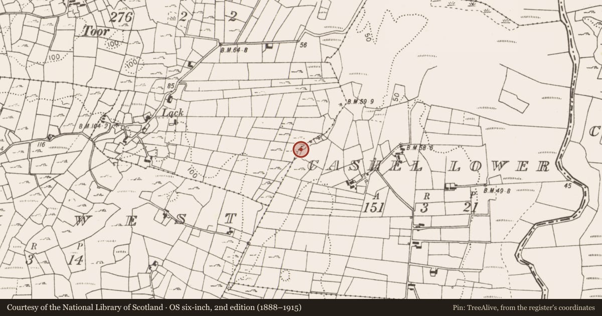
MA070-053005- was reported in the N half of the group. At the NW foot of a ridge in uneven rush-covered pasture, in a narrow overgrown strip of ground between the NNE-flowing stream to the W and a sturdy boundary wall to the E. The monument was not obviously visible when inspected in August 2025 but sub-surface deposits may survive intact.
Date of visit: 21-8-2025
Compiled by: Gearóid Conroy
References
Buckley, Victor M. & Lawless, Christy ‘Two C14 Dates for Fulachta Fiadh near Castlebar – Evidence for the Prehistoric ‘Mini Nuclear Winter’ in County Mayo’. Cathair na Mart – Journal of the Westport Historical Society, Vol. 8, No. 1, (1988), 23-25.
Buckley, Victor M. & Lawless, Christy ‘Prehistoric Cooking in Mayo’, Cathair na Mart – Journal of the Westport Historical Society, Vol. 7, No. 1, (1987), 32-36.
Nearby in the register
- Fulacht fiaunder 1 mi
- Fulacht fiaunder 1 mi
- Fulacht fiaunder 1 mi
- Fulacht fiaunder 1 mi
Other entries of the same register within about three miles of this one, by straight line.