Sites and Monuments Record · Ireland
Fulacht fia
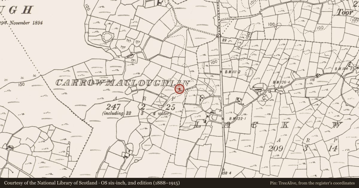
Carrowmacloughlin (Carra By.), County Mayo, Ireland
The record
- Townland
- Carrowmacloughlin (Carra By.)
- County
- Mayo
- Country
- Ireland
- First-edition OS map
- Not indicated
- Latest-edition OS map
- Not indicated
- Coordinates
- 53.91774, -9.19796
- SMR number
- MA070-041002-
Slide toward Today to fade the historical sheet and see the modern map underneath.
David Rumsey Map Collection, Stanford LibrariesDavid Rumsey Map Collection, Stanford LibrariesDavid Rumsey Map Collection, Stanford LibrariesDavid Rumsey Map Collection, Stanford Libraries
4 historical maps cover this location, the earliest the 1753 map "Mappa geographica Regni Hiberniae" (David Rumsey Map Collection, Stanford Libraries).
Historical maps covering this location
- 1753 · Mappa geographica Regni Hiberniae (David Rumsey Map Collection, Stanford Libraries)
- 1790 · Composite: Ireland. (David Rumsey Map Collection, Stanford Libraries)
- 1869 · Ireland. (David Rumsey Map Collection, Stanford Libraries)
- 1891 · Ireland 16 (David Rumsey Map Collection, Stanford Libraries)
This record in the National Monuments Service's Historic Environment Viewer ↗
The National Monuments Service's description
Reported as one of three possible fulachta fia; along with MA070-041001- c. 100m to the NNE and MA070-041003- c. 80m to the ENE (SMR file). On the N edge of a silted-up drain in low-lying damp rushy ground. A slightly raised and grass-covered, subcircular area (diams. 9m E-W; 8m N-S; max. H 0.2m) is surrounded by rushes except at S where a disused drain borders it. A poached area (Wth 3m; max. D 0.9m) has exposed burnt stone, ash, cinders and charcoal staining
Compiled by: Gearóid Conroy and Leo Morahan
Date of upload: 3-11-2025
Nearby in the register
- Fulacht fiaunder 1 mi
- Fulacht fiaunder 1 mi
- Fulacht fiaunder 1 mi
- Fulacht fiaunder 1 mi
Other entries of the same register within about three miles of this one, by straight line.