Sites and Monuments Record · Ireland
Burial mound
Roosky (Gallen By.), County Mayo, Ireland
The record
- Townland
- Roosky (Gallen By.)
- County
- Mayo
- Country
- Ireland
- First-edition OS map
- Not indicated
- Latest-edition OS map
- Not indicated
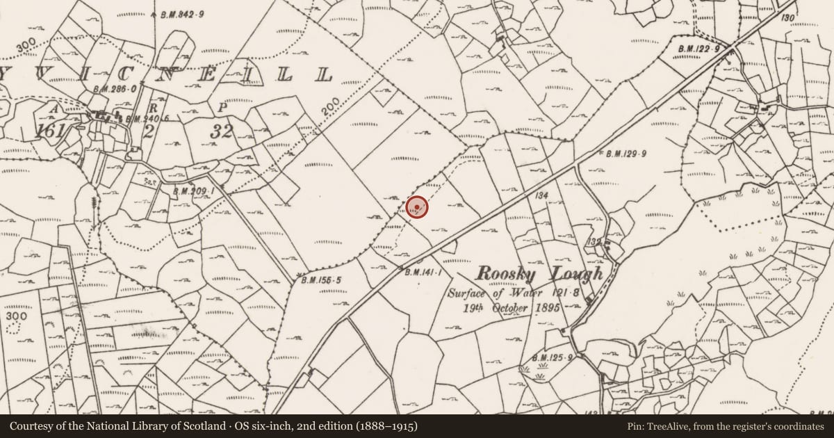
- Coordinates
- 54.03071, -9.08500
- SMR number
- MA049-162----
Slide toward Today to fade the historical sheet and see the modern map underneath.
David Rumsey Map Collection, Stanford LibrariesDavid Rumsey Map Collection, Stanford LibrariesDavid Rumsey Map Collection, Stanford LibrariesDavid Rumsey Map Collection, Stanford Libraries
4 historical maps cover this location, the earliest the 1753 map "Mappa geographica Regni Hiberniae" (David Rumsey Map Collection, Stanford Libraries).
Historical maps covering this location
- 1753 · Mappa geographica Regni Hiberniae (David Rumsey Map Collection, Stanford Libraries)
- 1790 · Composite: Ireland. (David Rumsey Map Collection, Stanford Libraries)
- 1869 · Ireland. (David Rumsey Map Collection, Stanford Libraries)
- 1891 · Ireland 16 (David Rumsey Map Collection, Stanford Libraries)
This record in the National Monuments Service's Historic Environment Viewer ↗
The National Monuments Service's description
Located in flat pasture, in the NW corner of a modern subrectangular field, bordered on the N side by a coniferous forestry plantation. The long spine of the Ox Mountains define the horizon to SE.
This monument is evident as a broad low, grass-covered subcircular mound (21m NE–SW; H 0.75m at SW, 1m at NE). It is very gently domed in profile, with a rather flattened top, grading seamlessly into broadly sloping sides. The N half of the mound is grass-covered, with small to medium-sized stones protruding randomly from the sod, and a greater density of stones visible on the perimeter at N–NE. The S–SE half of the mound is obscured by an impenetrable thicket of blackthorn scrub; stones are visible scattered across the surface beneath the scrub. According to local tradition, the mound is known as a burial site.
Attached images:
MA049-162----_01.JPG Viewed from E
MA049-162----_02.JPG Viewed from N
MA049-162----_03.JPG Viewed from NW
MA049-162----_014JPG Viewed from S
Notified to NMS by Gerry Walsh.
Compiled by: Jane O’Shaughnessy
Date of upload: 31 December 2019
Nearby in the register
- Enclosureunder 1 mi
- Field boundaryunder 1 mi
- Enclosureunder 1 mi
- Enclosureunder 1 mi
Other entries of the same register within about three miles of this one, by straight line.