Sites and Monuments Record · Ireland
Children's burial ground
Carrowgarve (Tirawley By.), County Mayo, Ireland
The record
- Townland
- Carrowgarve (Tirawley By.)
- County
- Mayo
- Country
- Ireland
- First-edition OS map
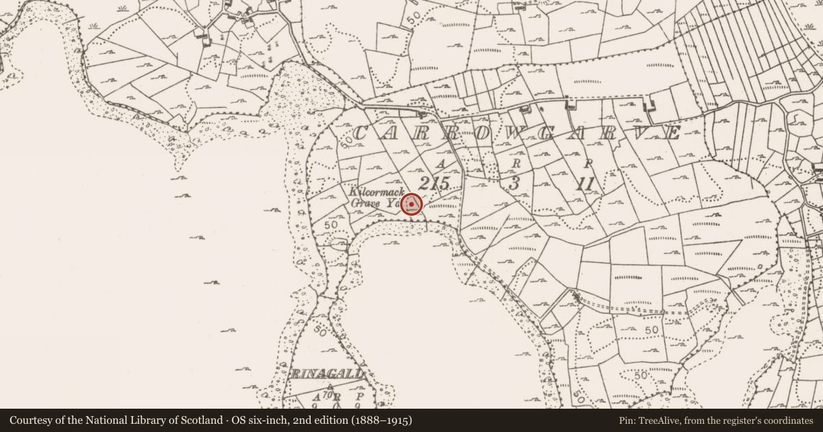
- Kilcormick Burial Gd.
- Latest-edition OS map
- Killeencormack Grave Yard
- Coordinates
- 54.01975, -9.20843
- SMR number
- MA048-037002-
Slide toward Today to fade the historical sheet and see the modern map underneath.
David Rumsey Map Collection, Stanford LibrariesDavid Rumsey Map Collection, Stanford LibrariesDavid Rumsey Map Collection, Stanford LibrariesDavid Rumsey Map Collection, Stanford Libraries
4 historical maps cover this location, the earliest the 1753 map "Mappa geographica Regni Hiberniae" (David Rumsey Map Collection, Stanford Libraries).
Historical maps covering this location
- 1753 · Mappa geographica Regni Hiberniae (David Rumsey Map Collection, Stanford Libraries)
- 1790 · Composite: Ireland. (David Rumsey Map Collection, Stanford Libraries)
- 1869 · Ireland. (David Rumsey Map Collection, Stanford Libraries)
- 1891 · Ireland 16 (David Rumsey Map Collection, Stanford Libraries)
This record in the National Monuments Service's Historic Environment Viewer ↗
The National Monuments Service's description
Situated on a SE facing slope, 30m from an inlet on the SE shoreline of Lough Conn.
Named ‘Kilcormac Grave Yard’ on the 1838 OS 6-inch map and ‘Killeencormack Burial Gd.’ on the 1922 edition,and listed by Aldridge (1969, 86-7) as a children’s burial ground. Slightly raised subtriangular area (28.3m NW-SE; 27.9m NNE-SSW) delimited in a broad curve at SSW−N by a low poorly defined scarp, and at E and S by linear field boundary walls. On the raised area are a considerable number of low, uninscribed upright stone gravemarkers. There are also a small number of tiny stone-lined graves. The burial ground may have been the site of a church (MA048-037001-). Built into the field boundary wall at E is a bullaun stone (see MA 048-037003-).
Compiled by: Jane O'Shaughnessy
Date of upload: 14 March 2018
References
Aldridge, R.B. 1969 Notes on children's burial grounds in Mayo. Journal of the Royal Society of Antiquaries of Ireland 99, 83-87.
Nearby in the register
- Churchunder 1 mi
- Bullaun stoneunder 1 mi
- Enclosureunder 1 mi
- Promontory fort - inlandunder 1 mi
Other entries of the same register within about three miles of this one, by straight line.