Sites and Monuments Record · Ireland
Megalithic tomb - unclassified
Carrowcrom, County Mayo, Ireland
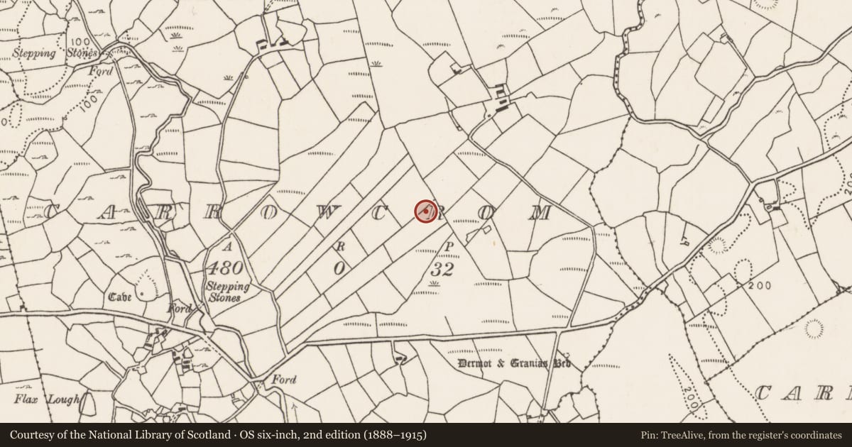
The record
- Townland
- Carrowcrom
- County
- Mayo
- Country
- Ireland
- First-edition OS map
- Not indicated
- Latest-edition OS map
- Not indicated
- Coordinates
- 54.09258, -9.05217
- SMR number
- MA040-017----
Slide toward Today to fade the historical sheet and see the modern map underneath.
David Rumsey Map Collection, Stanford LibrariesDavid Rumsey Map Collection, Stanford LibrariesDavid Rumsey Map Collection, Stanford LibrariesDavid Rumsey Map Collection, Stanford Libraries
4 historical maps cover this location, the earliest the 1790 map "Composite: Ireland." (David Rumsey Map Collection, Stanford Libraries).
Historical maps covering this location
- 1790 · Composite: Ireland. (David Rumsey Map Collection, Stanford Libraries)
- 1841 · Ireland. (David Rumsey Map Collection, Stanford Libraries)
- 1869 · Ireland. (David Rumsey Map Collection, Stanford Libraries)
- 1891 · Ireland 16 (David Rumsey Map Collection, Stanford Libraries)
This record in the National Monuments Service's Historic Environment Viewer ↗
The National Monuments Service's description
In gently undulating pasture, located on a low rise. The Ox Mountains define the skyline at E−S, and Nephin Mountain is visible in the distance to WSW.
This unclassified megalithic tomb is a National Monument (No. 293) in state care. It is not indicated on the 1838 and 1922 OS 6-inch maps, but was traditionally known as 'Dermot & Grania's Bed'. It was recorded in the early 20th-century in OPW Topographical Files as follows: ‘A slight mound and not quite complete megalithic grave, lying NW to SW and partly built into a modern stone fence in the N side. Grave about 12’ x 5’ [3.6m x 1.5m]. Right side stones remain (two at W end, four on S side, two at E end) while there are two stones 4’ x 3’ x 1’6” [1.2m x 0.9m x 0.45m] lying at 10’ [3m] to E.’
When inspected in 1996, it was evident as a stony mound (c. 4m NE−SW; 2.5m NW−SE; H 1.1m) with one large boulder visible on the perimeter at SSW, and bordered on the NW side by a NE−SW field fence.
Compiled by: Jane O'Shaughnessy
Date of upload: 18 June 2018
Nearby in the register
- Enclosureunder 1 mi
- Megalithic tomb - wedge tombunder 1 mi
- Standing stoneunder 1 mi
- Standing stoneunder 1 mi
Other entries of the same register within about three miles of this one, by straight line.