Sites and Monuments Record · Ireland
Ringfort - rath
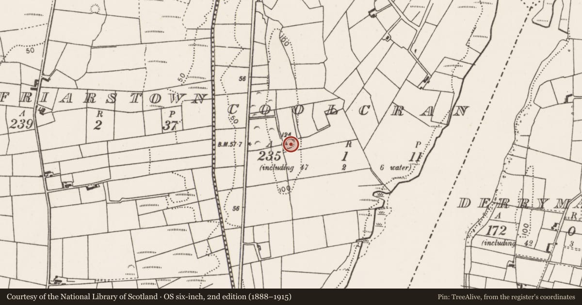
Coolcran (Tirawley By., Kilbelfad Par.), County Mayo, Ireland
The record
- Townland
- Coolcran (Tirawley By., Kilbelfad Par.)
- County
- Mayo
- Country
- Ireland
- First-edition OS map
- Indicated
- Coordinates
- 54.04984, -9.20420
- SMR number
- MA039-089----
Slide toward Today to fade the historical sheet and see the modern map underneath.
David Rumsey Map Collection, Stanford LibrariesDavid Rumsey Map Collection, Stanford LibrariesDavid Rumsey Map Collection, Stanford LibrariesDavid Rumsey Map Collection, Stanford Libraries
4 historical maps cover this location, the earliest the 1753 map "Mappa geographica Regni Hiberniae" (David Rumsey Map Collection, Stanford Libraries).
Historical maps covering this location
- 1753 · Mappa geographica Regni Hiberniae (David Rumsey Map Collection, Stanford Libraries)
- 1790 · Composite: Ireland. (David Rumsey Map Collection, Stanford Libraries)
- 1869 · Ireland. (David Rumsey Map Collection, Stanford Libraries)
- 1891 · Ireland 16 (David Rumsey Map Collection, Stanford Libraries)
This record in the National Monuments Service's Historic Environment Viewer ↗
The National Monuments Service's description
In pasture, in the SW corner of a modern field, located on a high, narrow N–S ridge, at the break of slope on the E side. There are excellent views over the surrounding lowlying grassland, with an area of flat wet land to E and W. A NE–SW expanse of boggy land, located c. 300m to SE, is a drained lake, named Derrymannin Lough on the 1838 OS 6-inch map.
Slightly raised circular area (diam. 19m N–S; 21m E–W) defined by an earthen bank (Wth 2.8m; int. H 0.6m; ext. H 0.85m). The inner slope of the bank has remnants of stone facing.
The interior has a very slight slope down to E; slight traces of cultivation ridges on an E–W axis are evident. A shallow depression (c. 4m E–W; 3m N–S) abuts the inner face of the bank at NE. There is a gap (Wth c. 2m) in the bank at SE, now rather ragged, but may have been an original entrance. Narrow, eroded breaks are evident at NNE and NW. Grass cover, with a few hawthorn bushes on the perimeter.
Compiled by: Jane O’Shaughnessy
Date of upload: 1 April 2020
Nearby in the register
- Enclosureunder 1 mi
- Ringfort - rathunder 1 mi
- Crannogunder 1 mi
- Castle - tower houseunder 1 mi
Other entries of the same register within about three miles of this one, by straight line.