Sites and Monuments Record · Ireland
Ringfort - rath
Ballinloughaun, County Mayo, Ireland
The record
- Townland
- Ballinloughaun
- County
- Mayo
- Country
- Ireland
- First-edition OS map
- Indicated
- Latest-edition OS map
- Hachured
- Coordinates
- 54.05644, -9.37758
- SMR number
- MA038-104----
Slide toward Today to fade the historical sheet and see the modern map underneath.
David Rumsey Map Collection, Stanford LibrariesDavid Rumsey Map Collection, Stanford LibrariesDavid Rumsey Map Collection, Stanford LibrariesDavid Rumsey Map Collection, Stanford Libraries
4 historical maps cover this location, the earliest the 1753 map "Mappa geographica Regni Hiberniae" (David Rumsey Map Collection, Stanford Libraries).
Historical maps covering this location
- 1753 · Mappa geographica Regni Hiberniae (David Rumsey Map Collection, Stanford Libraries)
- 1790 · Composite: Ireland. (David Rumsey Map Collection, Stanford Libraries)
- 1869 · Ireland. (David Rumsey Map Collection, Stanford Libraries)
- 1891 · Ireland 16 (David Rumsey Map Collection, Stanford Libraries)
This record in the National Monuments Service's Historic Environment Viewer ↗
The National Monuments Service's description
In pasture, located on a rise in gently undulating terrain. There is a stream 250m to W.
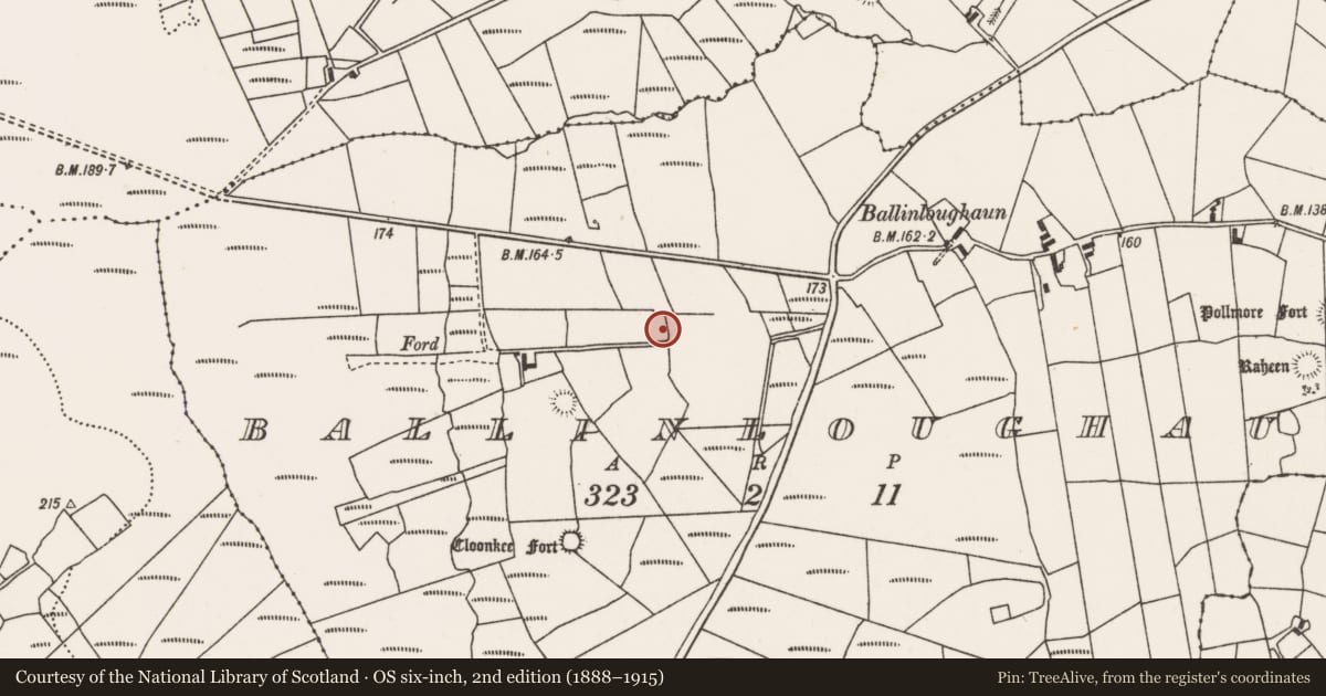
This enclosure is shown on the 1838 OS 6-inch map as a circular enclosure, clipped on its outer edge at S by an E-W road or laneway; on the 1922 edition it is shown as roughly D-shaped, truncated at E and S by straight field boundaries. It is evident now as a roughly D-shaped area (22.7m E-W; 20m N-S to field fence) defined on the curving side at SW–W by a low levelled undulation and NW–NE by a bank (Wth 2.1m; int. H 0.55m; ext. H 0.9m, at NNE) of earth and stone. The E arc is incorporated into a straight N–S field fence at NE–SE, and the S arc is truncated a straight E-W field fence. There is an eroded break (Wth 2.2m) in the bank at N. Traces of possible relict cultivation ridges on an E-W axis are visible in the interior. There is another rath (MA038-103----) 100m to SE and a children’s burial ground (MA038-168----) 130m to NW.
Compiled by: Jane O'Shaughnessy
Date of upload: 6 August 2019
Nearby in the register
- Children's burial groundunder 1 mi
- Ringfort - rathunder 1 mi
- Burnt moundunder 1 mi
- Ringfort - rathunder 1 mi
Other entries of the same register within about three miles of this one, by straight line.