Sites and Monuments Record · Ireland
Enclosure
Kilmoremoy, County Mayo, Ireland
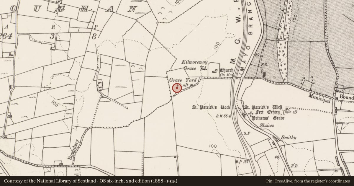
The record
- Townland
- Kilmoremoy
- County
- Mayo
- Country
- Ireland
- First-edition OS map
- Not indicated
- Latest-edition OS map
- Not indicated
- Coordinates
- 54.12193, -9.16700
- SMR number
- MA030-051005-
Slide toward Today to fade the historical sheet and see the modern map underneath.
David Rumsey Map Collection, Stanford LibrariesDavid Rumsey Map Collection, Stanford LibrariesDavid Rumsey Map Collection, Stanford LibrariesDavid Rumsey Map Collection, Stanford Libraries
4 historical maps cover this location, the earliest the 1790 map "Composite: Ireland." (David Rumsey Map Collection, Stanford Libraries).
Historical maps covering this location
- 1790 · Composite: Ireland. (David Rumsey Map Collection, Stanford Libraries)
- 1841 · Ireland. (David Rumsey Map Collection, Stanford Libraries)
- 1869 · Ireland. (David Rumsey Map Collection, Stanford Libraries)
- 1891 · Ireland 16 (David Rumsey Map Collection, Stanford Libraries)
This record in the National Monuments Service's Historic Environment Viewer ↗
The National Monuments Service's description
Located on the level top of an E-facing slope, enclosed within a burial ground named ‘League Cemetery’ (MA030-051004-).
This enclosure is not indicated on the 1837 and 1930 OS 6-inch maps. It consists of a slightly raised, roughly circular area (c. 27m N-S; c. 24m E-W) defined by a scarp. The scarp (H 1.2m at E) is well defined at NE−SE, but is difficult to trace at S where it is truncated by modern graves; it is low and poorly defined at SW−NW, and cannot be traced at NW−N, where it is engulfed by a dense thicket of overgrowth.
There are 18th- and 19th-century headstones and grave slabs, as well as a number of low uninscribed grave-markers throughout the interior. In the NE quadrant, a cross-inscribed stone (MA030-051007-) protrudes from the ground, and a possible bullaun stone (MA030-051006-) lies against the enclosure scarp at E. Kilmoremoy graveyard (MA030-05102-), which encloses a medieval church (MA030-05101-), is located 150m down-slope to E.
Compiled by: Jane O’Shaughnessy
Date of upload: 2 February 2021
Nearby in the register
- Cross-inscribed stoneunder 1 mi
- Bullaun stoneunder 1 mi
- Burial groundunder 1 mi
- Churchunder 1 mi
Other entries of the same register within about three miles of this one, by straight line.