Sites and Monuments Record · Ireland
Midden
Rosserk, County Mayo, Ireland
The record
- Townland
- Rosserk
- County
- Mayo
- Country
- Ireland
- First-edition OS map
- Not indictated
- Latest-edition OS map
- Not indicated
- Coordinates
- 54.17254, -9.14394
- SMR number
- MA022-124001-
Slide toward Today to fade the historical sheet and see the modern map underneath.
David Rumsey Map Collection, Stanford LibrariesDavid Rumsey Map Collection, Stanford LibrariesDavid Rumsey Map Collection, Stanford LibrariesDavid Rumsey Map Collection, Stanford Libraries
4 historical maps cover this location, the earliest the 1790 map "Composite: Ireland." (David Rumsey Map Collection, Stanford Libraries).
Historical maps covering this location
- 1790 · Composite: Ireland. (David Rumsey Map Collection, Stanford Libraries)
- 1841 · Ireland. (David Rumsey Map Collection, Stanford Libraries)
- 1869 · Ireland. (David Rumsey Map Collection, Stanford Libraries)
- 1891 · Ireland 16 (David Rumsey Map Collection, Stanford Libraries)
This record in the National Monuments Service's Historic Environment Viewer ↗
The National Monuments Service's description
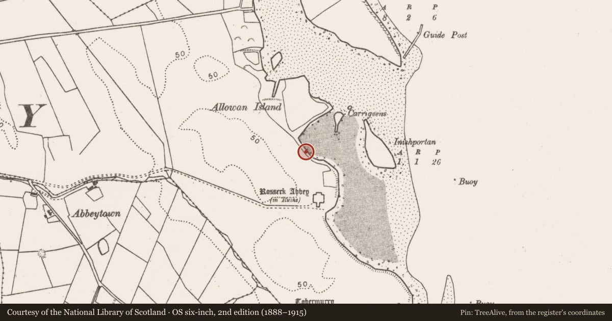
Located on the W shoreline at the narrow S end of the estuary of the River Moy. There are a number of small islands in the river at this point which are accessible across exposed sandflats at low tide. The midden is exposed in section towards the base of an almost vertical earthen scarp (H 1.5-2m) which serves as a field boundary defining the land edge bordering the river. The midden is visible as a dense layer (L c. 20m; T 0.2m) of cockle shells, with very occasional razor shells and periwinkles. The composition of the midden -predominantly cockle shells- reflects the local habitat of tidal sandflats.
Traces of another midden (MA022-124002-) are located c. 25m to N exposed in section in the same scarp. Rosserk Abbey (MA022-082001-) is located c. 80m to S.
Compiled by: Jane O’Shaughnessy
Date of upload: 17 June 2016
References
Kytmannow, T. 2011 Unpublished report to the Royal Irish Academy. Living on the Edge II: Archaeological Survey of the Moy Estuary, including the islands, Cos. Mayo/Sligo.
Nearby in the register
- Middenunder 1 mi
- Religious house - Franciscan Third Order Regularunder 1 mi
- Graveyardunder 1 mi
- Earthworkunder 1 mi
Other entries of the same register within about three miles of this one, by straight line.