Sites and Monuments Record · Ireland
Church
Crosspatrick, County Mayo, Ireland
The record
- Townland
- Crosspatrick
- County
- Mayo
- Country
- Ireland
- First-edition OS map
- Site of Church
- Latest-edition OS map
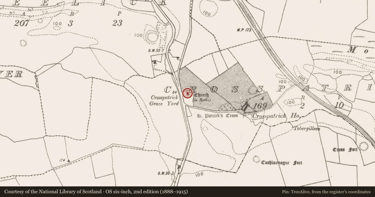
- Church (in Ruins)
- Coordinates
- 54.19774, -9.20237
- SMR number
- MA022-043001-
Slide toward Today to fade the historical sheet and see the modern map underneath.
David Rumsey Map Collection, Stanford LibrariesDavid Rumsey Map Collection, Stanford LibrariesDavid Rumsey Map Collection, Stanford LibrariesDavid Rumsey Map Collection, Stanford Libraries
4 historical maps cover this location, the earliest the 1790 map "Composite: Ireland." (David Rumsey Map Collection, Stanford Libraries).
Historical maps covering this location
- 1790 · Composite: Ireland. (David Rumsey Map Collection, Stanford Libraries)
- 1841 · Ireland. (David Rumsey Map Collection, Stanford Libraries)
- 1869 · Ireland. (David Rumsey Map Collection, Stanford Libraries)
- 1891 · Ireland 16 (David Rumsey Map Collection, Stanford Libraries)
This record in the National Monuments Service's Historic Environment Viewer ↗
The National Monuments Service's description
Located on elevated ground, within a graveyard (MA022-043002-).
This church is depicted on the 1838 and 1929 OS 6-inch maps as a rectangular building (7-8m ENE-WSW; 5-6m NW-SE); it is annotated ‘site of Church’ on the 1838 map and ‘Church (in Ruins)’ on the 1929 edition.
The outline of the church can no longer be traced. A remnant of a masonry wall (L 5-6m; H 2m; T c. 0.6-0.7m), on a ENE–WSW axis, may be a fragment of the church, possibly part of the S wall. A thick covering of ivy makes it difficult to examine, but it appears to be constructed of rectangular or square stone blocks, of roughly equal size. A rectangular grave plot (9m N-S; 5.4m E-W) outlined by a low mortared stone wall (Wth 0.45m; H 0.4m) is appended to the N side of the possible church wall, and encloses a 19th-century table tomb.
Attached images:
MA022-043001-_01.JPG Ivy covered wall, possibly part of church, with 19th century grave plot in front, viewed from N.
Compiled by: Jane O’Shaughnessy
Date of upload: 1 May 2019
Nearby in the register
- Graveyardunder 1 mi
- Cross-inscribed stoneunder 1 mi
- Inscribed stoneunder 1 mi
- Barrow - ring-barrowunder 1 mi
Other entries of the same register within about three miles of this one, by straight line.