Sites and Monuments Record · Ireland
Ringfort - rath
Croghan, County Mayo, Ireland
The record
- Townland
- Croghan
- County
- Mayo
- Country
- Ireland
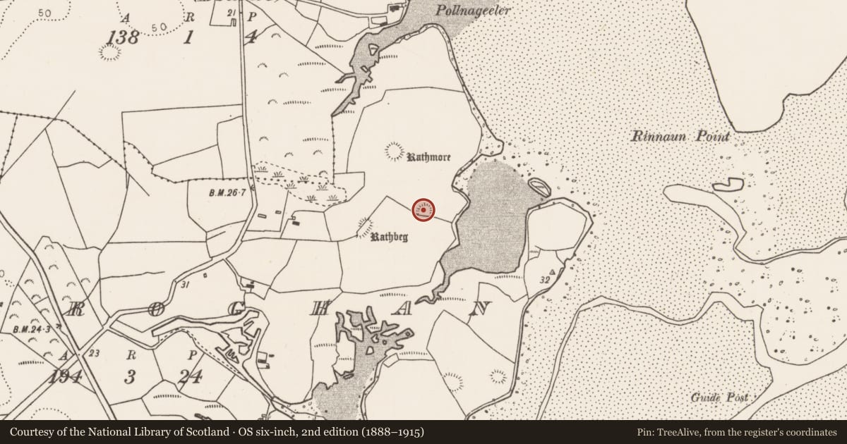
- First-edition OS map
- Indicated
- Latest-edition OS map
- Hachured
- Coordinates
- 54.22390, -9.21579
- SMR number
- MA015-051----
Slide toward Today to fade the historical sheet and see the modern map underneath.
David Rumsey Map Collection, Stanford LibrariesDavid Rumsey Map Collection, Stanford LibrariesDavid Rumsey Map Collection, Stanford LibrariesDavid Rumsey Map Collection, Stanford Libraries
4 historical maps cover this location, the earliest the 1790 map "Composite: Ireland." (David Rumsey Map Collection, Stanford Libraries).
Historical maps covering this location
- 1790 · Composite: Ireland. (David Rumsey Map Collection, Stanford Libraries)
- 1841 · Ireland. (David Rumsey Map Collection, Stanford Libraries)
- 1869 · Ireland. (David Rumsey Map Collection, Stanford Libraries)
- 1891 · Ireland 16 (David Rumsey Map Collection, Stanford Libraries)
This record in the National Monuments Service's Historic Environment Viewer ↗
The National Monuments Service's description
In pasture, at the SE end of a NW–SE rise in gently undulating coastal terrain, with good views in all directions. A small inlet in the SW shoreline of Killala Bay is 50m to E.
Raised oval area (22.4m ESE–WNW; 16.8m NNE–SSW) defined by a scarp (Wth slope 2.8m; H 1.3m at N). The scarp is well defined at SW–ESE, and for short stretches at ESE and WSW it retains a low internal rim (Wth c. 1m; int. H 0.1-0.3m). At WSW a few stones protrude from the inner edge of the raised rim of the scarp. At N large stones also protrude about mid-way down the external slope of the scarp. The scarp has been modified and incorporated into a later field fence at SE–SW; it is topped with stones and a hedge of thorn bushes and brambles. The interior is flat and featureless, with overgrowth encroaching on the S half.
There is a rath (MA015-050----) c. 100m to NW, and another (MA015-052----) is 100m to SSW. Two other raths (MA015-053----; MA015-054----) are visible c. 300m to SSE.
Compiled by: Jane O’Shaughnessy
Date of upload: 6 December 2018
Nearby in the register
- Ringfort - rathunder 1 mi
- Ringfort - rathunder 1 mi
- Ringfort - rathunder 1 mi
- House - indeterminate dateunder 1 mi
Other entries of the same register within about three miles of this one, by straight line.