Sites and Monuments Record · Ireland
Barrow - unclassified
Townplots West, County Mayo, Ireland
The record
- Townland
- Townplots West
- County
- Mayo
- Country
- Ireland
- First-edition OS map
- Indicated
- Latest-edition OS map
- Hachured
- Coordinates
- 54.21734, -9.24099
- SMR number
- MA015-044005-
Slide toward Today to fade the historical sheet and see the modern map underneath.
David Rumsey Map Collection, Stanford LibrariesDavid Rumsey Map Collection, Stanford LibrariesDavid Rumsey Map Collection, Stanford LibrariesDavid Rumsey Map Collection, Stanford Libraries
4 historical maps cover this location, the earliest the 1790 map "Composite: Ireland." (David Rumsey Map Collection, Stanford Libraries).
Historical maps covering this location
- 1790 · Composite: Ireland. (David Rumsey Map Collection, Stanford Libraries)
- 1841 · Ireland. (David Rumsey Map Collection, Stanford Libraries)
- 1869 · Ireland. (David Rumsey Map Collection, Stanford Libraries)
- 1891 · Ireland 16 (David Rumsey Map Collection, Stanford Libraries)
This record in the National Monuments Service's Historic Environment Viewer ↗
The National Monuments Service's description
Located on a small peak on top of a knoll, in an area of rolling average pasture dotted with drumlin-like knolls and hummocks. There are good views in all direction: Rathfran Bay is visible to E, the Ox mountains to SE, and Nephin and the Nephin Beg range to W–SW.
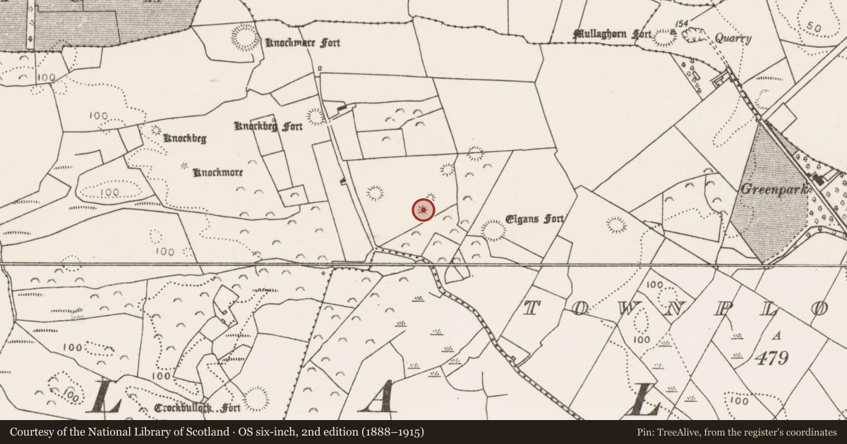
This is shown on the 1838 and 1922 OS 6-inch maps as a small circular enclosure (diam. 10-15m). It is evident as low, circular slightly domed rise (diam. c. 6-7m; H 0.4m) on top of the knoll. It is degraded and poorly defined. Another possible barrow (MA015-044006-) is located 15m to NNE. There are a wedge tomb (MA015-044007-) and two enclosures (MA015-044002- and MA015-044003-) c. 70m to NE; there is a rath (MA015-044004-) c. 100m to SE and another (MA015-044001-) c. 100m to NW.
Compiled by: Jane O’Shaughnessy
Date of upload: 6 December 2018
Nearby in the register
- Barrow - unclassifiedunder 1 mi
- Megalithic tomb - wedge tombunder 1 mi
- Enclosureunder 1 mi
- Ringfort - rathunder 1 mi
Other entries of the same register within about three miles of this one, by straight line.