Sites and Monuments Record · Ireland
Ringfort - rath
Townplots West, County Mayo, Ireland
The record
- Townland
- Townplots West
- County
- Mayo
- Country
- Ireland
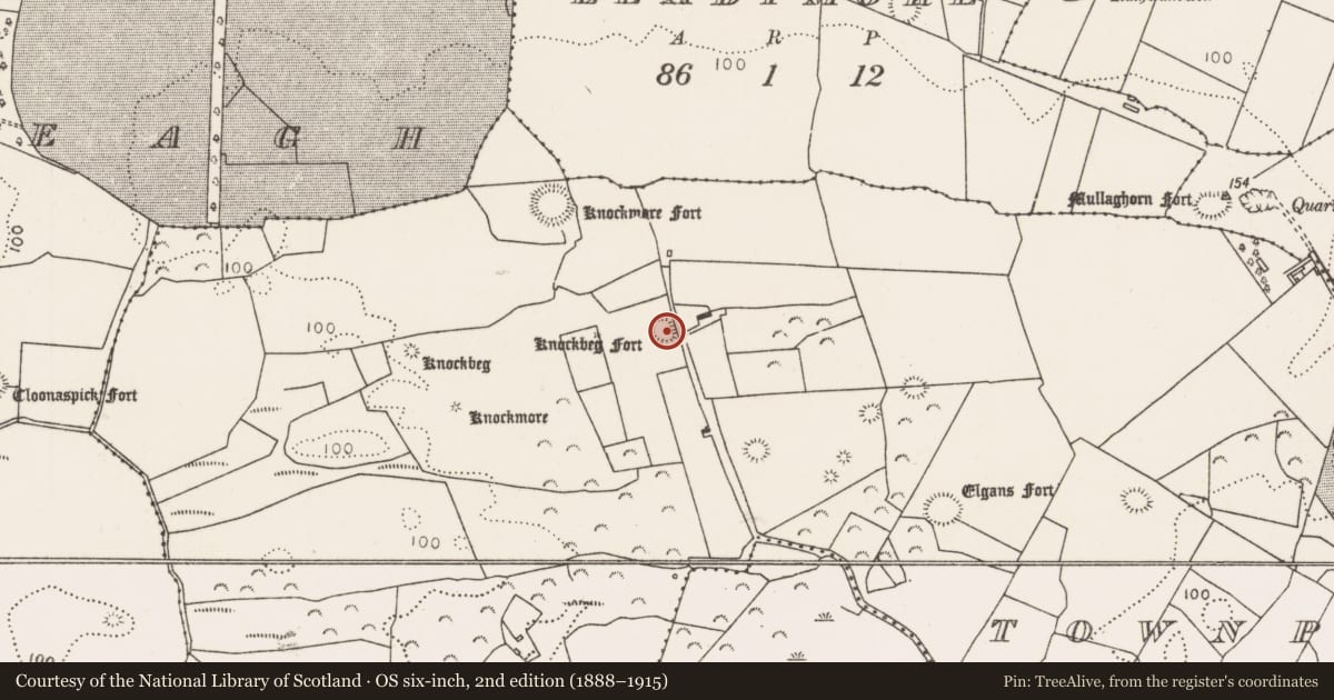
- First-edition OS map
- Knockbeg Fort
- Latest-edition OS map
- Knockbeg Fort
- Coordinates
- 54.21898, -9.24417
- SMR number
- MA015-043----
Slide toward Today to fade the historical sheet and see the modern map underneath.
David Rumsey Map Collection, Stanford LibrariesDavid Rumsey Map Collection, Stanford LibrariesDavid Rumsey Map Collection, Stanford LibrariesDavid Rumsey Map Collection, Stanford Libraries
4 historical maps cover this location, the earliest the 1790 map "Composite: Ireland." (David Rumsey Map Collection, Stanford Libraries).
Historical maps covering this location
- 1790 · Composite: Ireland. (David Rumsey Map Collection, Stanford Libraries)
- 1841 · Ireland. (David Rumsey Map Collection, Stanford Libraries)
- 1869 · Ireland. (David Rumsey Map Collection, Stanford Libraries)
- 1891 · Ireland 16 (David Rumsey Map Collection, Stanford Libraries)
This record in the National Monuments Service's Historic Environment Viewer ↗
The National Monuments Service's description
In pasture, on a rise in rolling terrain dotted with drumlin-like knolls. There are good views, particularly to W.
Raised circular area (22m E–W; 23m N–S) defined at NE–SE by remnants of a bank (Wth c. 3m; int. H 0.2m; ext. H 0.8m at E), reduced elsewhere to a scarp (H 1.5m at S, 0.8m at W), and enclosed by a fosse (2-2.4m at W) and at SE–N by an external bank (Wth 3.2m; int. H 0.8m; ext. H 0.7m). At N and NE–E the external bank has been truncated by two intersecting field fences on E–W and N–S axes. A short length of the external bank has also been truncated at SSW by a quarry pit (diam. 8m). The centre of the interior appears very slightly higher tha, with a slight slope down from there to S. Blackthorn, hawthorn and brambles grow around the perimeter. There is a rath (MA015-042----) 165m to NW, and there is a cluster of raths, enclosures, possible barrows and a wedge tomb (MA015-044001- to MA015-044006-) c. 160m to SE.
Compiled by: Jane O’Shaughnessy
Date of upload: 6 December 2018
Nearby in the register
- Ringfort - rathunder 1 mi
- Ringfort - rathunder 1 mi
- Megalithic tomb - wedge tombunder 1 mi
- Barrow - unclassifiedunder 1 mi
Other entries of the same register within about three miles of this one, by straight line.