Sites and Monuments Record · Ireland
Ringfort - rath
Castlereagh (Tirawley By.), County Mayo, Ireland
The record
- Townland
- Castlereagh (Tirawley By.)
- County
- Mayo
- Country
- Ireland
- First-edition OS map
- Indicated
- Latest-edition OS map
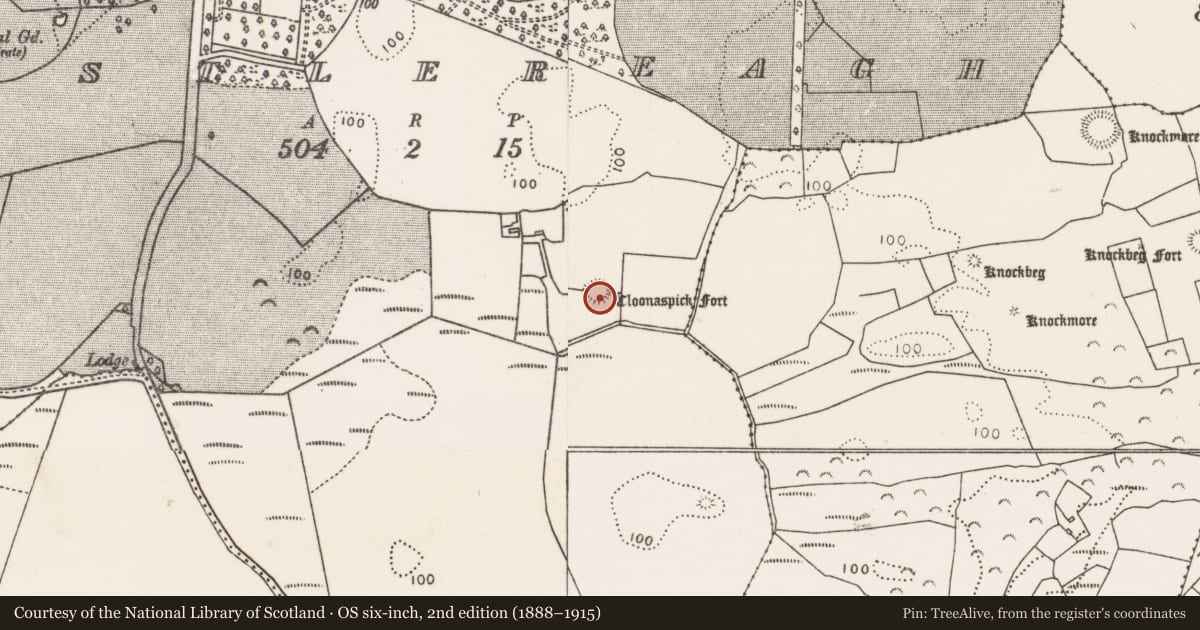
- Cloonaspick Fort
- Coordinates
- 54.21829, -9.25715
- SMR number
- MA015-039----
Slide toward Today to fade the historical sheet and see the modern map underneath.
David Rumsey Map Collection, Stanford LibrariesDavid Rumsey Map Collection, Stanford LibrariesDavid Rumsey Map Collection, Stanford LibrariesDavid Rumsey Map Collection, Stanford Libraries
4 historical maps cover this location, the earliest the 1790 map "Composite: Ireland." (David Rumsey Map Collection, Stanford Libraries).
Historical maps covering this location
- 1790 · Composite: Ireland. (David Rumsey Map Collection, Stanford Libraries)
- 1841 · Ireland. (David Rumsey Map Collection, Stanford Libraries)
- 1869 · Ireland. (David Rumsey Map Collection, Stanford Libraries)
- 1891 · Ireland 16 (David Rumsey Map Collection, Stanford Libraries)
This record in the National Monuments Service's Historic Environment Viewer ↗
The National Monuments Service's description
In pasture, straddling the E side of a low rise in rolling terrain dotted with drumlin-like knolls. Immediately to W there is an expanse of lowlying wet pasture. There is a canalised stream/drain 30m to S. Views are good generally, somewhat restricted to N by gently rising ground.
This rath is named ‘Cloonaspick Fort’ on the 1838 and 1922 OS 6-inch maps. It consists of a circular area (estimated diam. c. 30m) defined by an earthen bank/scarp (H 0.4m at NNW; 0.7-0.8m at SE, 1.2m at W), outside which is a fosse (Wth 2m) with an external bank (Wth 3.5m; int. H 1m; ext. H 0.1m at W). Dense blackthorn bushes have colonised the interior, and an almost impenetrable ring of blackthorn, brambles and ash trees grow on the perimeter. Where the inner bank/scarp can be accessed, it appears to be well defined, retaining a slight internal lip at SE. The fosse survives as a distinct depression on the W half, but at E is merely a level gap between the two banks. The external bank is evident as a low, sod-covered rise topped with stone in parts, rather degraded at NE, with several eroded gaps.
Compiled by: Jane O’Shaughnessy
Date of upload: 6 December 2018
Nearby in the register
Other entries of the same register within about three miles of this one, by straight line.