Sites and Monuments Record · Ireland
Excavation - miscellaneous
Carrowsteelagh, County Mayo, Ireland
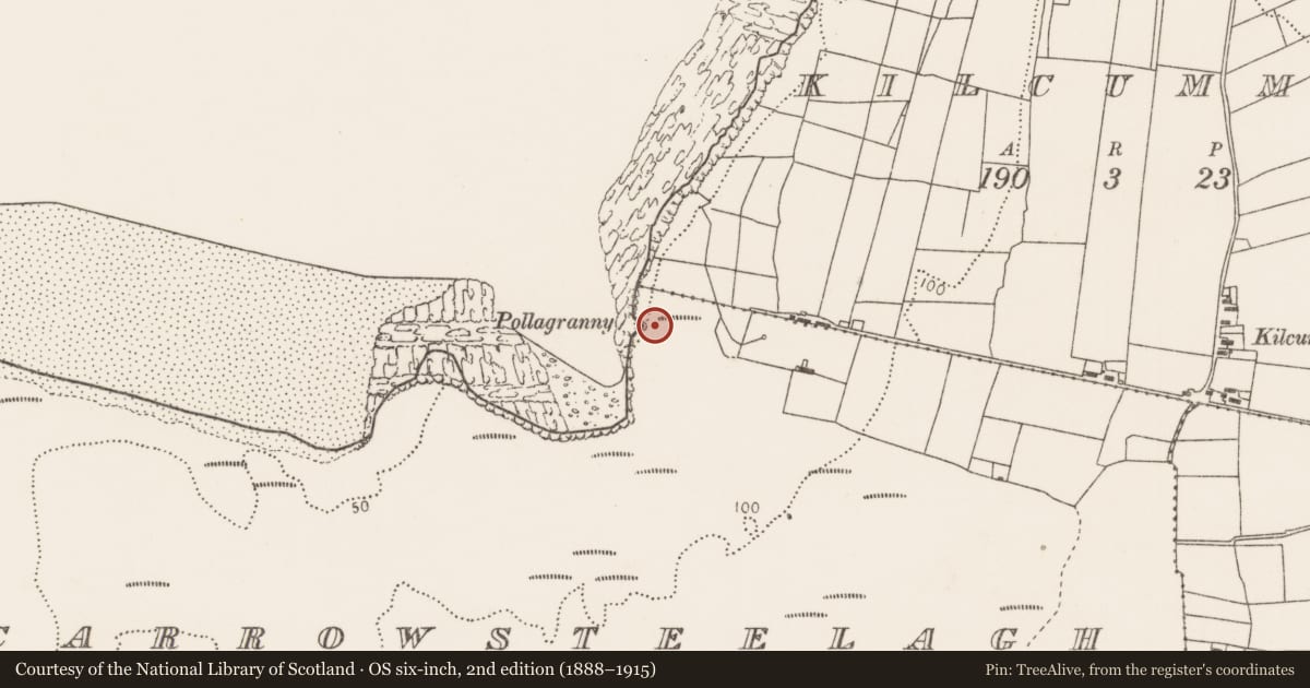
The record
- Townland
- Carrowsteelagh
- County
- Mayo
- Country
- Ireland
- First-edition OS map
- Not indicated
- Latest-edition OS map
- Not indicated
- Coordinates
- 54.28004, -9.22677
- SMR number
- MA008-010004-
Slide toward Today to fade the historical sheet and see the modern map underneath.
David Rumsey Map Collection, Stanford LibrariesDavid Rumsey Map Collection, Stanford LibrariesDavid Rumsey Map Collection, Stanford LibrariesDavid Rumsey Map Collection, Stanford Libraries
4 historical maps cover this location, the earliest the 1790 map "Composite: Ireland." (David Rumsey Map Collection, Stanford Libraries).
Historical maps covering this location
- 1790 · Composite: Ireland. (David Rumsey Map Collection, Stanford Libraries)
- 1841 · Ireland. (David Rumsey Map Collection, Stanford Libraries)
- 1869 · Ireland. (David Rumsey Map Collection, Stanford Libraries)
- 1891 · Ireland 16 (David Rumsey Map Collection, Stanford Libraries)
This record in the National Monuments Service's Historic Environment Viewer ↗
The National Monuments Service's description
Located adjacent to an elongated mound (MA008-010001-), on a cliff edge overlooking the E side of Lacken Bay. Two cist graves (MA008-010002-; MA008-010003-), which underlay the mound, were excavated in 1990 by the National Museum in the same year (Cahill and Sikora 2011, 102-6). In 1991 another short excavation (E000617) was undertaken. It was confined to a small area on the S side of the mound, c. 6m from its mid point, where a number of large upright stones were exposed by road works (Walsh, 1991). A narrow cutting (2m N–S; 1.5m E–W) revealed a setting of five slabs, set on edge in an E–W row. These may have formed part of a kerb or revetment to the mound. A compacted charcoal-rich layer (T 0.05M), containing small fragments of burnt wood and small burnt stones, was found immediately outside the row of stones. It was overlain by thin sandy and gravelly layers containing charcoal fragments. A number of chert implements were recovered (Walsh, 1991).
Compiled by: Jane O'Shaughnessy
Date of upload: 15 July 2019
References
Walsh, G. 1991 Excavations in the vicinity of a long burial mound at Carrowsteelagh, Lackan, County Mayo (E617) July 1991. Unpublished excavation report submitted to NMS.
Nearby in the register
- Moundunder 1 mi
- Slab-lined burialunder 1 mi
- Slab-lined burialunder 1 mi
- Barrow - unclassifiedunder 1 mi
Other entries of the same register within about three miles of this one, by straight line.