Sites and Monuments Record · Ireland
Church
Ballingarry, County Limerick, Ireland
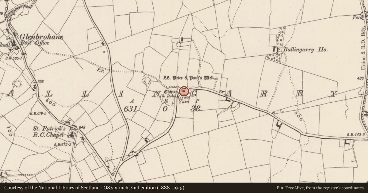
The record
- Townland
- Ballingarry
- County
- Limerick
- Country
- Ireland
- First-edition OS map
- Church (in ruins)
- Latest-edition OS map
- Church (in Ruins) (1928)
- Coordinates
- 52.38265, -8.37536
- SMR number
- LI049-107001-
Slide toward Today to fade the historical sheet and see the modern map underneath.
David Rumsey Map Collection, Stanford LibrariesDavid Rumsey Map Collection, Stanford LibrariesDavid Rumsey Map Collection, Stanford LibrariesDavid Rumsey Map Collection, Stanford Libraries
4 historical maps cover this location, the earliest the 1790 map "Composite: Ireland." (David Rumsey Map Collection, Stanford Libraries).
Historical maps covering this location
- 1790 · Composite: Ireland. (David Rumsey Map Collection, Stanford Libraries)
- 1882 · Ireland (southern half). (David Rumsey Map Collection, Stanford Libraries)
- 1891 · Ireland 16 (David Rumsey Map Collection, Stanford Libraries)
- 1904 · Sheet 13. (David Rumsey Map Collection, Stanford Libraries)
This record in the National Monuments Service's Historic Environment Viewer ↗
The National Monuments Service's description
Westropp (1904-5, 452-3) recorded the following details about Ballingarry Church also known as Garth; 'Garthegrifnn, in Natherlach, 1291; Garthe, in Natherlagh, 1302. Alicia, widow of Griffin de Rupe, had a suit about lands, a mill, turbary, and pasture in Garthegriffin and Olethere, Kilboygnam, and O'Tran; elsewhere given as Garthegriffen, in Olehere; Foxnoceston, in Any; and Olethill, in Kilboynagh, 1294-7 (Plea R. 22 of xxv Ed. I, m. 48; 32, m. 7,and 36 of xxvi, m. 20). Ballingarrie Church, 1607 (Pat. R.). "There is noe habitacon or other thing remarkable in this parish, save only a mill seate and the walls of a church upon the lands of Ballingarry," 1656 (D.S. (A), 53). Fabric - The west gable of a rude ruined church near SS. Peter's and Paul's Well [LI049-108----], 20 feet 3 inches [6.2m] wide : featureless'.
Compiled by: Caimin O'Brien
Date of upload: 26 June 2019
References
ASIAP - Archaeological Survey of Ireland Aerial Photographs (c. 1996 - c. 2010).
Westropp, T.J. 1904-5 A survey of the ancient churches of Co. Limerick. Proceedings of the Royal Irish Academy 25C, 327-479.
Nearby in the register
- Graveyardunder 1 mi
- Ritual site - holy wellunder 1 mi
- Ringfort - rathunder 1 mi
- Ogham stoneunder 1 mi
Other entries of the same register within about three miles of this one, by straight line.