Sites and Monuments Record · Ireland
Urn burial
Cush, County Limerick, Ireland
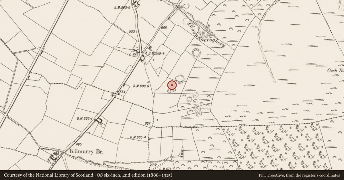
The record
- Townland
- Cush
- County
- Limerick
- Country
- Ireland
- First-edition OS map
- Not indicated
- Latest-edition OS map
- Grave (Urn found 1924)
- Coordinates
- 52.38205, -8.44464
- SMR number
- LI048-034038-
Slide toward Today to fade the historical sheet and see the modern map underneath.
David Rumsey Map Collection, Stanford LibrariesDavid Rumsey Map Collection, Stanford LibrariesDavid Rumsey Map Collection, Stanford LibrariesDavid Rumsey Map Collection, Stanford Libraries
4 historical maps cover this location, the earliest the 1790 map "Composite: Ireland." (David Rumsey Map Collection, Stanford Libraries).
Historical maps covering this location
- 1790 · Composite: Ireland. (David Rumsey Map Collection, Stanford Libraries)
- 1882 · Ireland (southern half). (David Rumsey Map Collection, Stanford Libraries)
- 1891 · Ireland 16 (David Rumsey Map Collection, Stanford Libraries)
- 1904 · Sheet 13. (David Rumsey Map Collection, Stanford Libraries)
This record in the National Monuments Service's Historic Environment Viewer ↗
The National Monuments Service's description
In reclaimed pasture, ringfort (LI048-034008-) 27m to NE, two burial mounds (LI048-034011-012-) immediately to S. In centre of an archaeological complex (LI048-034006/042-) located on the 'Supposed Site of Temaír Erann', which was the ancient cemetery of the Ernai tribe on Slievereagh (Sliabh Riabhach) (Westropp 1919, 9; Westropp 1917-19, 179; Westropp 1918, 111). Excavations of a burial mound (LI048-034010-) listed as ‘Tumulus I’ by Ó Ríordáin (1940, 133-137) between 1934-5, revealed a cist (LI048-034039-). An un burial had previously been recorded during excavations of this burial mound in 1924. According to Ó Ríordáin, ‘the cremated remains found in 1924 were then re-interred at the same spot in an ordinary geranium pot. This re-interred burial was found by us near the centre of the Tumulus [LI048-034010-], as were also some further urn fragments’ (ibid. 1935).
See attached plans by Ó Ríordáin.
Compiled by: Fiona Rooney
Date of upload: 27 August 2021
References
Westropp, T.J. 1919 The ancient places of assembly in the counties Limerick and Clare. Journal of the Royal Society of Antiquaries of Ireland 49, 1-24.
Waddell, J. 1970 Irish Bronze Age cists, a survey. Journal of the Royal Society of Antiquaries of Ireland 100, 91-139.
Kavanagh, R.M. 1973 The Encrusted Urn in Ireland. Proceedings of the Royal Irish Academy 73C, 507-617.
Westropp, T.J. 1918 Temair Erann, an Ancient Cemetery of the Ernai on Slievereagh, County Limerick. Journal of the Royal Society of Antiquities of Ireland, 111-20.
Westropp, T.J. 1917-19 The Earthworks, Traditions, and the Gods of South-Eastern Co. Limerick, Especially from Knocklong to Temair Erann. Proceedings of the Royal Irish Academy: Archaeology, Culture, History, Literature 34, 127-183.
Ó Ríordáin, S.P. 1940 Excavations at Cush, Co. Limerick (1934 and 1935). Proceedings of the Royal Irish Academy 45, 83-181.
Nearby in the register
- Barrow - bowl-barrowunder 1 mi
- Cistunder 1 mi
- Quarryunder 1 mi
- Cremated remainsunder 1 mi
Other entries of the same register within about three miles of this one, by straight line.