Sites and Monuments Record · Ireland
Standing stone
Cush, County Limerick, Ireland
The record
- Townland
- Cush
- County
- Limerick
- Country
- Ireland
- First-edition OS map
- Not indicated
- Latest-edition OS map
- Pillar Stone (1928)
- Coordinates
- 52.38073, -8.44231
- SMR number
- LI048-034024-
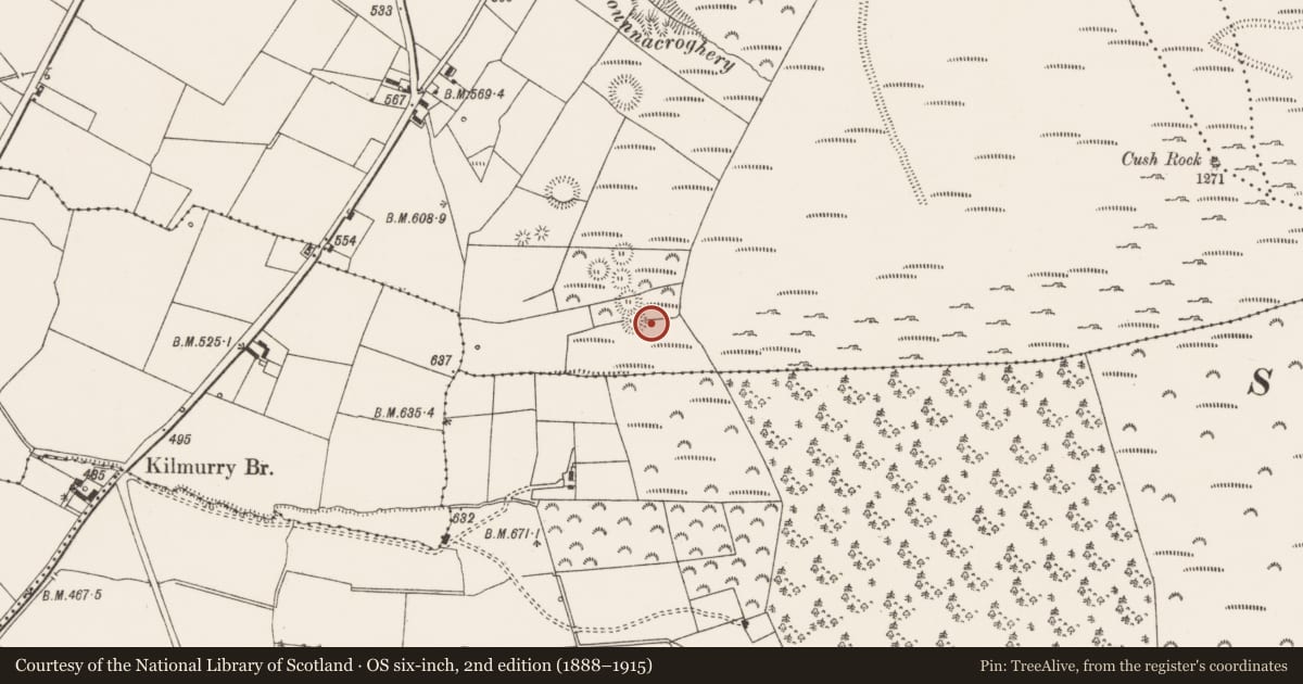
Slide toward Today to fade the historical sheet and see the modern map underneath.
David Rumsey Map Collection, Stanford LibrariesDavid Rumsey Map Collection, Stanford LibrariesDavid Rumsey Map Collection, Stanford LibrariesDavid Rumsey Map Collection, Stanford Libraries
4 historical maps cover this location, the earliest the 1790 map "Composite: Ireland." (David Rumsey Map Collection, Stanford Libraries).
Historical maps covering this location
- 1790 · Composite: Ireland. (David Rumsey Map Collection, Stanford Libraries)
- 1882 · Ireland (southern half). (David Rumsey Map Collection, Stanford Libraries)
- 1891 · Ireland 16 (David Rumsey Map Collection, Stanford Libraries)
- 1904 · Sheet 13. (David Rumsey Map Collection, Stanford Libraries)
This record in the National Monuments Service's Historic Environment Viewer ↗
The National Monuments Service's description
In rough pasture, in S quadrant of an archaeological complex (LI048-034006/042-) located on the 'Supposed Site of Temaír Erann', which was the ancient cemetery of the Ernai tribe on Slievereagh (Sliabh Riabhach) (Westropp 1919, 9; Westropp 1917-19, 179; Westropp 1918, 111). Immediately SE of ringfort (LI048-034016), annotated ‘Pillar Stone’ on the Cassini ed. OSi 6-inch map. Westropp (1916-19, 167) described it a consisting of; ‘A low pillar, 5’ 6” [1.65m] and leaning over, stands 26’ [7.92m] distant from the southern ring and to the east.’ Listed by Grogan (1989, Vol. 2, 269) as 'Cush 2'. Possible standing stone visible on Google Earth orthoimage taken 28/06/2018.
Compiled by: Fiona Rooney
Date of upload: 7 September 2021
References
Westropp, T.J. 1917-19 The Earthworks, Traditions, and the Gods of South-Eastern Co. Limerick, Especially from Knocklong to Temair Erann. Proceedings of the Royal Irish Academy: Archaeology, Culture, History, Literature 34, 127-183.
Westropp, T.J. 1918 Temair Erann, an Ancient Cemetery of the Ernai on Slievereagh, County Limerick. Journal of the Royal Society of Antiquities of Ireland, 111-20.
Grogan, E. 1989 The Early Prehistory of the Lough Gur Region: Neolithic and Bronze Age settlement patterns in North Munster, south of the River Shannon, 3 Vols. Doctoral PhD Thesis submitted to the Dept. of Archaeology, University College Dublin.
Westropp, T.J. 1916-19 The later Pagan sanctuaries of Co. Limerick. Journal of the North Munster Antiquarian Society 4, 3, 157-83.
Westropp, T.J. 1919 The ancient places of assembly in the counties Limerick and Clare. Journal of the Royal Society of Antiquaries of Ireland 49, 1-24.
Nearby in the register
- Ringfort - rathunder 1 mi
- Souterrainunder 1 mi
- Urn burialunder 1 mi
- Cistunder 1 mi
Other entries of the same register within about three miles of this one, by straight line.