Sites and Monuments Record · Ireland
Hillfort
Knocksouna, County Limerick, Ireland
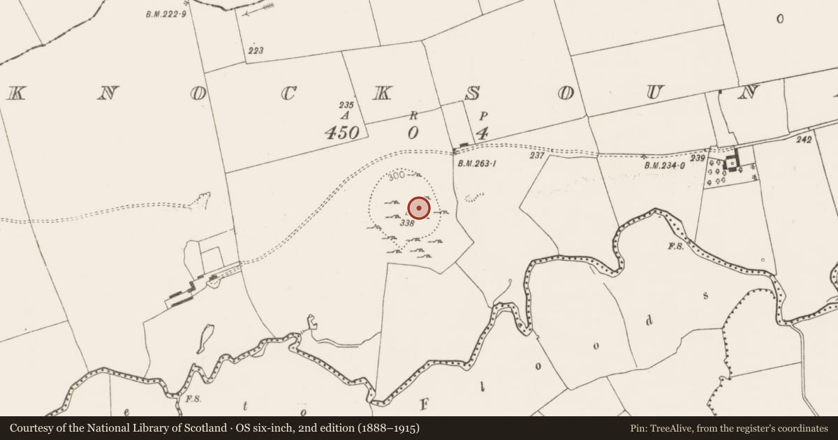
The record
- Townland
- Knocksouna
- County
- Limerick
- Country
- Ireland
- First-edition OS map
- Not indicated
- Latest-edition OS map
- Outlined
- Coordinates
- 52.40174, -8.63903
- SMR number
- LI047-092----
Slide toward Today to fade the historical sheet and see the modern map underneath.
David Rumsey Map Collection, Stanford LibrariesDavid Rumsey Map Collection, Stanford LibrariesDavid Rumsey Map Collection, Stanford LibrariesDavid Rumsey Map Collection, Stanford Libraries
4 historical maps cover this location, the earliest the 1790 map "Composite: Ireland." (David Rumsey Map Collection, Stanford Libraries).
Historical maps covering this location
- 1790 · Composite: Ireland. (David Rumsey Map Collection, Stanford Libraries)
- 1883 · Ireland 3. (David Rumsey Map Collection, Stanford Libraries)
- 1891 · Ireland 16 (David Rumsey Map Collection, Stanford Libraries)
- 1904 · Sheet 13. (David Rumsey Map Collection, Stanford Libraries)
This record in the National Monuments Service's Historic Environment Viewer ↗
The National Monuments Service's description
The hillfort was recently described in the Atlas of Hillforts of Britain and Ireland as following; 'W of the village of Killmallock, circular multiple enclosure surrounding the summit of isolated hill overlooking the Loobagh River 200m to the S. The site has a total footprint of approximately 2.8ha. Bivallate for most of its circuit with widely spaced enclosing elements. No recorded entrance features. Immediately outside the inner enclosing element to the N are a number of earthworks and terraces which may comprise hut structures and relict field divisions. The internal enclosing element survives as a low lying bank. The outer enclosing feature is heavily overgrown and to the E is incorporated into a modern field system. The E side of the interior is overgrown with scrub. There have been no archaeological investigations of this hillfort. The hillfort was not recorded in any historic mapping' (http://hillforts.arch.ox.ac.uk/records/IR0684.html).
Compiled by: Caimin O’Brien
Date of upload: 30 January 2020
References
Lock, G. and Ralston, I. 2017 Atlas of Hillforts of Britain and Ireland.(Online website at https://hillforts.arch.ox.ac.uk)
Nearby in the register
- Moated siteunder 1 mi
- Churchunder 1 mi
- Graveyardunder 1 mi
- Moated siteunder 1 mi
Other entries of the same register within about three miles of this one, by straight line.