Sites and Monuments Record · Ireland
House - medieval
Kilmallock, County Limerick, Ireland
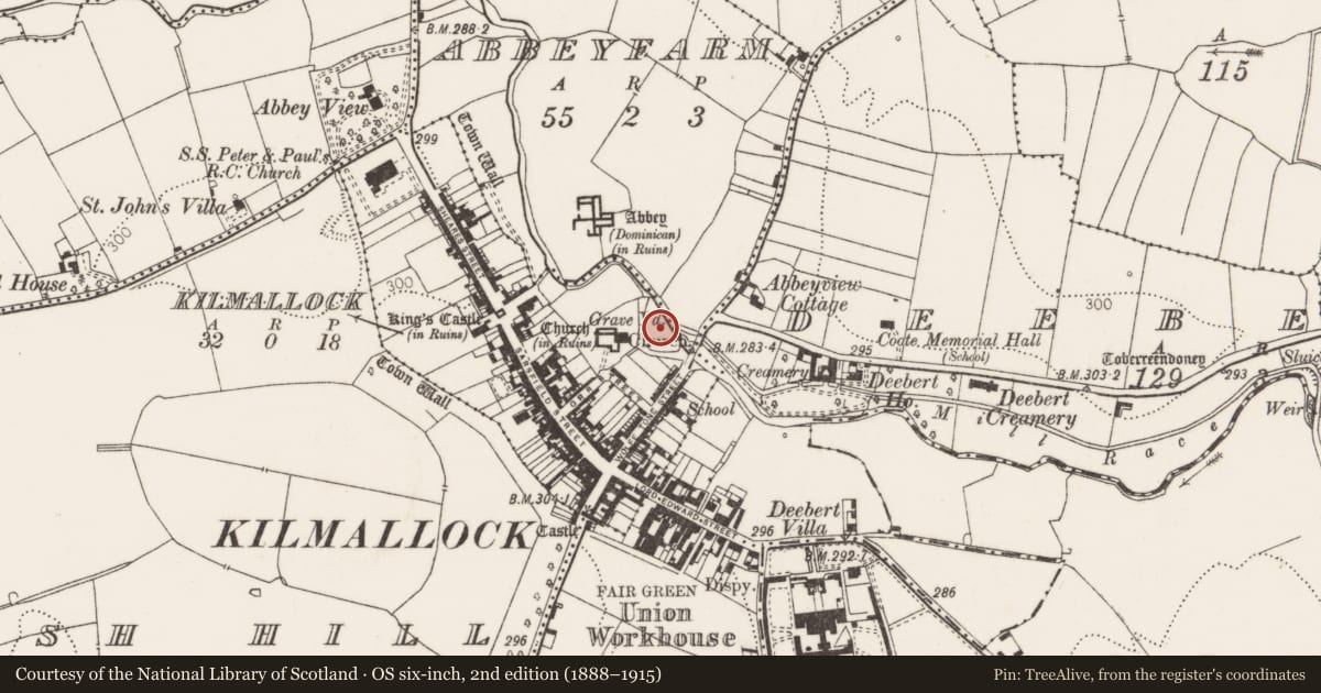
The record
- Townland
- Kilmallock
- County
- Limerick
- Country
- Ireland
- First-edition OS map
- Not indicated
- Latest-edition OS map
- Not indicated
- Coordinates
- 52.40121, -8.57362
- SMR number
- LI047-022063-
Slide toward Today to fade the historical sheet and see the modern map underneath.
David Rumsey Map Collection, Stanford LibrariesDavid Rumsey Map Collection, Stanford LibrariesDavid Rumsey Map Collection, Stanford LibrariesDavid Rumsey Map Collection, Stanford Libraries
4 historical maps cover this location, the earliest the 1790 map "Composite: Ireland." (David Rumsey Map Collection, Stanford Libraries).
Historical maps covering this location
- 1790 · Composite: Ireland. (David Rumsey Map Collection, Stanford Libraries)
- 1882 · Ireland (southern half). (David Rumsey Map Collection, Stanford Libraries)
- 1891 · Ireland 16 (David Rumsey Map Collection, Stanford Libraries)
- 1904 · Sheet 13. (David Rumsey Map Collection, Stanford Libraries)
This record in the National Monuments Service's Historic Environment Viewer ↗
The National Monuments Service's description
No surface remains visible of medieval house and bawn depicted on a map of Kilmallock town dating from c. 1600 (TCD, MS 1209/62). On this map a large house standing inside a walled area possibly a bawn is depicted standing on an island on the River Loobagh immediately E of the town wall (LI047-022006-) and parish church (LI047-022009-) of Kilmallock. A multi-arched stone bridge (LI047-022057-) crossing the River Loobagh is shown to the E of the house and bawn.
Thomas (1992, 135) described this island and its house as following; 'The island (1600 map) has a rather artificial shape with a clear boundary and a central building which, while not a mill, could have been a church set in parkland or a house, possibly of the bishop of Limerick or a noble, its setting being more unique than its structure which was similar to the houses along the main street (1600 map)'.
Compiled by: Caimin O'Brien
Date of upload: 30 September 2019
References
TCD, MS 1209/62 Trinity College Dublin, Towne of Kilmallock in the County of Limerick, per Joanes. Hardiman Atlas. Dublin.
Thomas, A. 1992 The walled towns of Ireland, 2 vols. Dublin. Irish Academic Press.
Nearby in the register
- Bridgeunder 1 mi
- Churchunder 1 mi
- Memorial stoneunder 1 mi
- Tomb - unclassifiedunder 1 mi
Other entries of the same register within about three miles of this one, by straight line.