Sites and Monuments Record · Ireland
House - 16th century
Kilmallock, County Limerick, Ireland
The record
- Townland
- Kilmallock
- County
- Limerick
- Country
- Ireland
- Coordinates
- 52.40122, -8.57634
- SMR number
- LI047-022052-
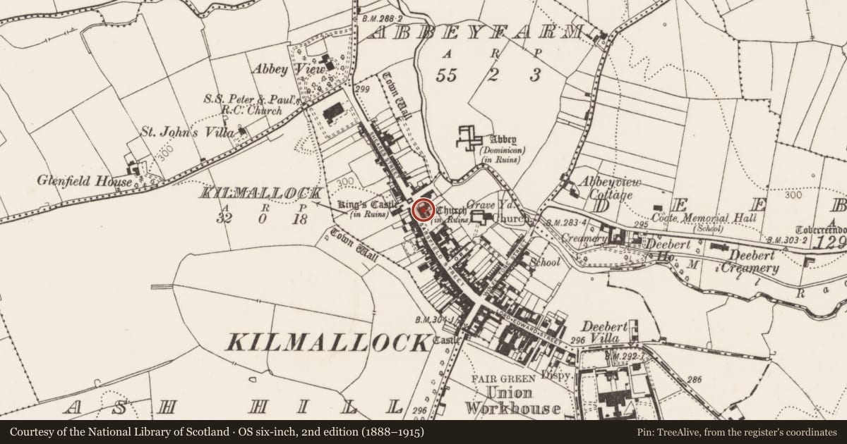
Slide toward Today to fade the historical sheet and see the modern map underneath.
David Rumsey Map Collection, Stanford LibrariesDavid Rumsey Map Collection, Stanford LibrariesDavid Rumsey Map Collection, Stanford LibrariesDavid Rumsey Map Collection, Stanford Libraries
4 historical maps cover this location, the earliest the 1790 map "Composite: Ireland." (David Rumsey Map Collection, Stanford Libraries).
Historical maps covering this location
- 1790 · Composite: Ireland. (David Rumsey Map Collection, Stanford Libraries)
- 1882 · Ireland (southern half). (David Rumsey Map Collection, Stanford Libraries)
- 1891 · Ireland 16 (David Rumsey Map Collection, Stanford Libraries)
- 1904 · Sheet 13. (David Rumsey Map Collection, Stanford Libraries)
This record in the National Monuments Service's Historic Environment Viewer ↗
The National Monuments Service's description
Testing was carried out by Linda G. Lynch under licence No. 06E0266 in advance of the proposed renovation and extension of a building. This development is to be extended into the backyard of the existing house, the northern boundary of which is formed by the extant wall of an earlier medieval building (and also forms part of the extant structure on site). The site lies to the south-east of King’s Castle, the building which now projects into the main street of Kilmallock.
Three trenches were excavated by machine and cleaned by hand across the site in order to ascertain if there were archaeological deposits remaining on the site and, if so, at what depth. Several layers were identified on the site that may be archaeological in nature.
In Trenches 1 and 3 an archaeologically sealed layer was identified at a depth of c. 0.6m below the existing ground level. Pottery of a late medieval or post-medieval date was found at this depth and it is likely that there is material of an earlier date beneath this. Nothing of an archaeological nature was identified in Trench 2. Material in this trench appeared to have been disturbed, possibly during the construction of later drains (www.excavations.ie).
Nearby in the register
- Excavation - miscellaneousunder 1 mi
- Castle - tower houseunder 1 mi
- Excavation - miscellaneousunder 1 mi
- Excavation - miscellaneousunder 1 mi
Other entries of the same register within about three miles of this one, by straight line.