Sites and Monuments Record · Ireland
Tomb - chest tomb
Kilmallock, County Limerick, Ireland
The record
- Townland
- Kilmallock
- County
- Limerick
- Country
- Ireland
- Coordinates
- 52.40102, -8.57466
- SMR number
- LI047-022012-
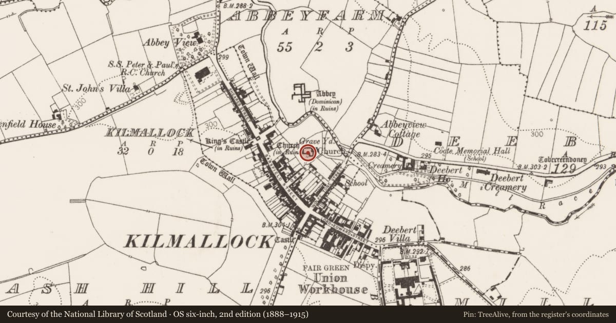
Slide toward Today to fade the historical sheet and see the modern map underneath.
David Rumsey Map Collection, Stanford LibrariesDavid Rumsey Map Collection, Stanford LibrariesDavid Rumsey Map Collection, Stanford LibrariesDavid Rumsey Map Collection, Stanford Libraries
4 historical maps cover this location, the earliest the 1790 map "Composite: Ireland." (David Rumsey Map Collection, Stanford Libraries).
Historical maps covering this location
- 1790 · Composite: Ireland. (David Rumsey Map Collection, Stanford Libraries)
- 1882 · Ireland (southern half). (David Rumsey Map Collection, Stanford Libraries)
- 1891 · Ireland 16 (David Rumsey Map Collection, Stanford Libraries)
- 1904 · Sheet 13. (David Rumsey Map Collection, Stanford Libraries)
This record in the National Monuments Service's Historic Environment Viewer ↗
The National Monuments Service's description
17th century Verdon-Coppinger tomb at Kilmallock described in the Urban Survey of County Limerick as following (Bradley et. al. 1989, 160); 'Verdon-Coppinqer tomb. 1627. - Rectangular slab carved with a male and female figure in Elizabethan costume, two winged angles with trumpets, coats of arms and an inscription:
DNO IONNI VERDVNO/ EIVS QVE RELICIAE ILLS D. ALSON HALY CON-IVGI SVAE ILLS/ D. WALTERVS COP/ PINGE/ R EQVES AVRATVS HOC FVN-ERIS ET AMORIS MONVMENT/ VM POSVIT ANO DNI/ 1627/ D. ALSONA HA/ LY OBIIT ANO SALVTIS 1626 2/OCTOBR : ETATIS SVE 6/ D. IONNES VERDVN OBIIT ANO/ SALVTIS/ 1614:19 AVGVSTI. AETATIS SVAE 63
The following is above the coats of arms SVRGITE M/ ORTVI/ VENITE AD IVDICIVM
Mems Dead i (1888-91), 214-7; Westropp 1904-5, 420-1'.
Compiled by: Caimin O’Brien
Date of upload: 27 September 2019
References
Bradley, J., Halpin, A., and King, H.A. 1989 Urban archaeological survey - county Limerick (3 vols.). Unpublished report commissioned by the Office of Public Works, Dublin.
Westropp, T.J. 1904-5 A survey of the ancient churches of Co. Limerick. Proceedings of the Royal Irish Academy 25C, 327-479.
Nearby in the register
- Tomb - chest tombunder 1 mi
- Tomb - chest tombunder 1 mi
- Tomb - unclassifiedunder 1 mi
- Memorial stoneunder 1 mi
Other entries of the same register within about three miles of this one, by straight line.