Sites and Monuments Record · Ireland
Road - road/trackway
Raheennamadra, County Limerick, Ireland
The record
- Townland
- Raheennamadra
- County
- Limerick
- Country
- Ireland
- First-edition OS map
- Not indicated
- Latest-edition OS map
- Not indicated
- Coordinates
- 52.41921, -8.39233
- SMR number
- LI041-013010-
Slide toward Today to fade the historical sheet and see the modern map underneath.
David Rumsey Map Collection, Stanford LibrariesDavid Rumsey Map Collection, Stanford LibrariesDavid Rumsey Map Collection, Stanford LibrariesDavid Rumsey Map Collection, Stanford Libraries
4 historical maps cover this location, the earliest the 1790 map "Composite: Ireland." (David Rumsey Map Collection, Stanford Libraries).
Historical maps covering this location
- 1790 · Composite: Ireland. (David Rumsey Map Collection, Stanford Libraries)
- 1882 · Ireland (southern half). (David Rumsey Map Collection, Stanford Libraries)
- 1891 · Ireland 16 (David Rumsey Map Collection, Stanford Libraries)
- 1904 · Sheet 13. (David Rumsey Map Collection, Stanford Libraries)
This record in the National Monuments Service's Historic Environment Viewer ↗
The National Monuments Service's description
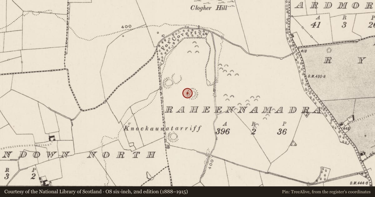
In pasture, a ringfort (LI041-013011-) lies 13m to the SE and a road (LI041-013013-) runs parallel 50m to the NW. Not depicted on OSi historic maps. Westropp (1917-19, 67) described ‘an old track, 45 feet [13m] from it (LI041-013011-) towards the conjoined rings (LI041-013005/007-), runs between the “forts”’. No surface remains visible on Digital Globe orthoimage taken between 2011-13. Trace of a linear cropmark (L. 26m) running NE-SW intersected at NE by a modern field boundary, is visible on Google Earth orthoimage dated 18/11/2018.
See attached plan taken from Westropp (1917-19) and Google Earth orthoimages.
Compiled by: Fiona Rooney
Date of upload: 29 July 2021
See attached ASI aerial photographs ASIAP – 343/20 and 21 on 05/01/2003.
References
Westropp, T.J. 1919 The ancient places of assembly in the counties Limerick and Clare. Journal of the Royal Society of Antiquaries of Ireland 49, 1-24.
Westropp, T.J. 1916-19 The Later Pagan Sanctuaries of Co. Limerick. Journal of the North Munster Antiquarian Society 4, 2, 122-48, 157-83.
ASIAP - Archaeological Survey of Ireland Aerial Photographs (c. 1996 - c. 2010).
Westropp, T.J. 1917-19 The Ancient Sanctuaries of Knockainey and Clogher, County Limerick, and Their
Goddesses. Proceedings of the Royal Irish Academy: Archaeology, Culture, History, Literature 34, 47-67.
Nearby in the register
- Ringfort - rathunder 1 mi
- Hut siteunder 1 mi
- Souterrainunder 1 mi
- Burialunder 1 mi
Other entries of the same register within about three miles of this one, by straight line.