Sites and Monuments Record · Ireland
Ritual site - holy well
Kilfrush, County Limerick, Ireland
The record
- Townland
- Kilfrush
- County
- Limerick
- Country
- Ireland
- First-edition OS map
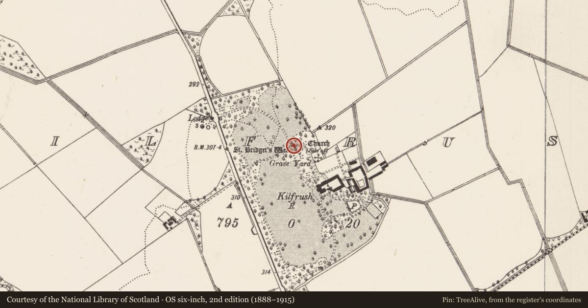
- St Bridgets Well
- Latest-edition OS map
- St Bridgets Well (1927)
- Coordinates
- 52.45633, -8.42198
- SMR number
- LI040-034----
Slide toward Today to fade the historical sheet and see the modern map underneath.
David Rumsey Map Collection, Stanford LibrariesDavid Rumsey Map Collection, Stanford LibrariesDavid Rumsey Map Collection, Stanford LibrariesDavid Rumsey Map Collection, Stanford Libraries
4 historical maps cover this location, the earliest the 1790 map "Composite: Ireland." (David Rumsey Map Collection, Stanford Libraries).
Historical maps covering this location
- 1790 · Composite: Ireland. (David Rumsey Map Collection, Stanford Libraries)
- 1882 · Ireland (southern half). (David Rumsey Map Collection, Stanford Libraries)
- 1891 · Ireland 16 (David Rumsey Map Collection, Stanford Libraries)
- 1904 · Sheet 13. (David Rumsey Map Collection, Stanford Libraries)
This record in the National Monuments Service's Historic Environment Viewer ↗
The National Monuments Service's description
Ó Danachair (1955, 216) recorded the following details about the holy well; "St Bridget's Well" on 1840 map. Tradition in the district is unanimous in calling this "St Colman's Well" and not "St Bridget's Well". OSL gives "Tobar Colmain, S. Colman's Well", but OSNB gives "St Bridget's Holy Well". No second well is known in tradition. The well has a good spring of clear water. Formerly a large tree stood over the well, but this has been felled in recent years, and the water piped away to provide drinking water for cattle. All devotion has ceased, although the well was formerly very popular. The water cured eye ailments, and rags were left on the tree as offerings.
The Ordnance Survey Letters recorded that this well was 'called Tobar Cholmáin, Saint Colman's Well, which is frequented on Saturday evening, particularly by persons labouring under diseases that effect the eye. Two ash trees stand over it' (OSL Kilfrush Parish, 93).
Compiled by: Caimin O'Brien
Date of upload: 17 June 2019
References
Ó Danachair, C. 1955 The Holy Wells of County Limerick Journal of the Royal Society of Antiquaries of Ireland 85, 193-217
Nearby in the register
- Graveyardunder 1 mi
- Churchunder 1 mi
- Earthworkunder 1 mi
- Barrow - unclassifiedunder 1 mi
Other entries of the same register within about three miles of this one, by straight line.