Sites and Monuments Record · Ireland
Church
Templebredon, County Limerick, Ireland
The record
- Townland
- Templebredon
- County
- Limerick
- Country
- Ireland
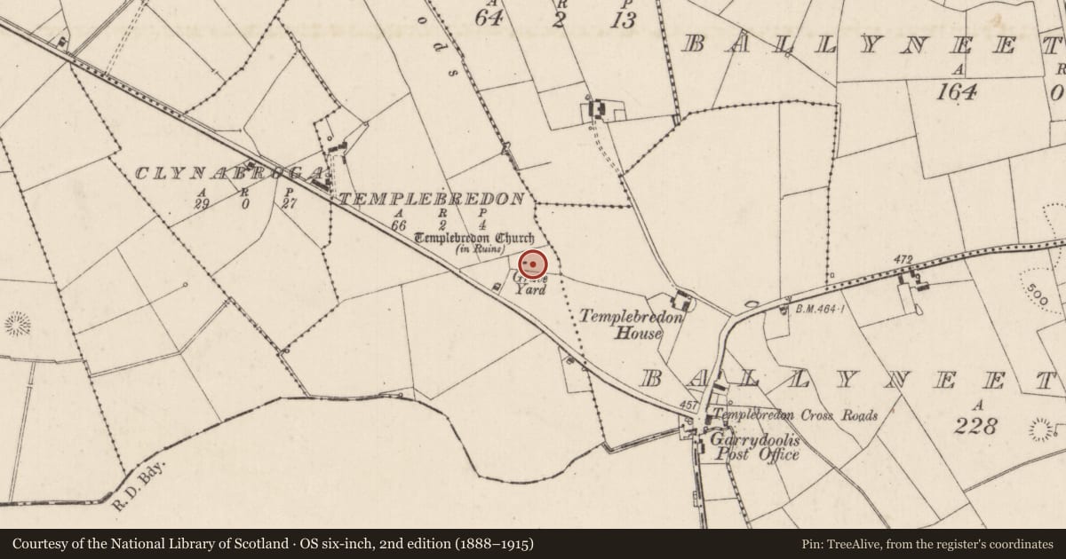
- First-edition OS map
- Templebredon Church (in ruins)
- Latest-edition OS map
- Templebredon Church (in Ruins)
- Coordinates
- 52.51520, -8.33951
- SMR number
- LI033-037001-
Slide toward Today to fade the historical sheet and see the modern map underneath.
David Rumsey Map Collection, Stanford LibrariesDavid Rumsey Map Collection, Stanford LibrariesDavid Rumsey Map Collection, Stanford LibrariesDavid Rumsey Map Collection, Stanford Libraries
4 historical maps cover this location, the earliest the 1790 map "Composite: Ireland." (David Rumsey Map Collection, Stanford Libraries).
Historical maps covering this location
- 1790 · Composite: Ireland. (David Rumsey Map Collection, Stanford Libraries)
- 1882 · Ireland (southern half). (David Rumsey Map Collection, Stanford Libraries)
- 1891 · Ireland 16 (David Rumsey Map Collection, Stanford Libraries)
- 1904 · Sheet 13. (David Rumsey Map Collection, Stanford Libraries)
This record in the National Monuments Service's Historic Environment Viewer ↗
The National Monuments Service's description
Westropp (1904-5, 445-6) recorded the following details about Templebredon Church; A parish in Coonagh. Kerrygyrinois, or Templibryden, held with.Tuathclugin, 1559 (Fiants, 84); Templebrydan, 1568 (ib., 1258). Granted with Aney, Ballenloghey, Kilkellan, or Kilfelan, Owla, or Olence, Downealong, &c, to W. Neave, in trust, 1703. (Pat. R.); Teampull Ui Brigdean [O'Bredon], the O'Bredons' church (O'Donovan). Fabric - It was 58 feet by 24 feet; the east part of south wall, 14 feet long, and 9 feet by 3 feet of old-looking masonry, stood in 1840 (O.S.L., 8, 1)'.
Poorly preserved remains of Templebredon church in centre of graveyard (LI033-037002-). Rectangular-shaped area (dims. 6m N-S; 12.5m E-W) defined by collapsed sod covered walls (Wth 3.9m; int. H 0.6m; ext. H 0.8m) best preserved along W and W end of N and S walls. Large chest tomb built into E end of S wall. Sod cleared from mid-way along S wall, where fabric is disturbed due to recent interment. Interior generally clear in W half, with a scattering of twentieth century gravestones. Small pile of architectural fragments in SW quadrant and large pile of rubble stone within S side of E end of church. Single architectural fragment to E may be part of sill stone. Two other sill stone fragments to E of church; one complete sill is standing vertical adjacent to a headstone and a second fragment is smaller and is adjacent a large plot with modern kerbing.
Compiled by: Caimin O'Brien
Date of upload: 26 April 2019
References
Westropp, T.J. 1904-5 A survey of the ancient churches of Co. Limerick. Proceedings of the Royal Irish Academy 25C, 327-479.
Nearby in the register
- Graveyardunder 1 mi
- Moated siteunder 1 mi
- Enclosureunder 1 mi
- Barrow - unclassifiedunder 1 mi
Other entries of the same register within about three miles of this one, by straight line.