Sites and Monuments Record · Ireland
Earthwork
Derk, County Limerick, Ireland
The record
- Townland
- Derk
- County
- Limerick
- Country
- Ireland
- First-edition OS map
- Not indicated
- Latest-edition OS map
- Not indicated
- Coordinates
- 52.52376, -8.34276
- SMR number
- LI033-036010-
Slide toward Today to fade the historical sheet and see the modern map underneath.
David Rumsey Map Collection, Stanford LibrariesDavid Rumsey Map Collection, Stanford LibrariesDavid Rumsey Map Collection, Stanford LibrariesDavid Rumsey Map Collection, Stanford Libraries
4 historical maps cover this location, the earliest the 1790 map "Composite: Ireland." (David Rumsey Map Collection, Stanford Libraries).
Historical maps covering this location
- 1790 · Composite: Ireland. (David Rumsey Map Collection, Stanford Libraries)
- 1882 · Ireland (southern half). (David Rumsey Map Collection, Stanford Libraries)
- 1891 · Ireland 16 (David Rumsey Map Collection, Stanford Libraries)
- 1904 · Sheet 13. (David Rumsey Map Collection, Stanford Libraries)
This record in the National Monuments Service's Historic Environment Viewer ↗
The National Monuments Service's description
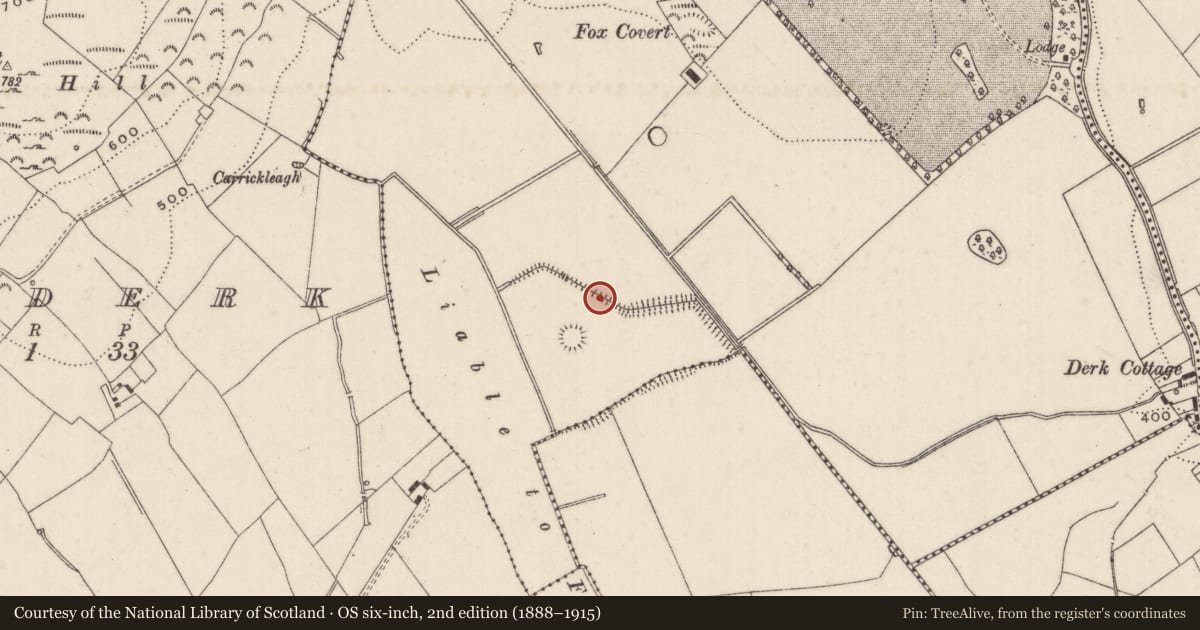
In reclaimed pasture, on the demesne lands of Derk House located 490m to NNE. In the centre of a cluster of 14 barrows (LI033-036001/009; LI033-090/91-; LI033-121/122-; LI033-154----) concentrated in the S half of Derk townland. Regular pattern of linear ditches combined with upstanding field boundaries clearly visible on OSi orthophoto taken between 2005-12. The linear ditches running roughly parallel to each other on a NW-SE axis feeding into drainage ditches indicated on OSi historic maps. Surveyed by the ASI in 2007 and described as a linear mound (L 90m; Wth 3.5m; H 0.2m) running NW-SE defined by a channel (Wth 3.4m; D 0.25m) on either side with a similar mound and drains running perpendicular. Remains of drainage channels associated with land reclamation on the demesne lands of Derk House. Not the remains of a pre-1700 field system, no evidence for pattern of fields and no evidence for any cultivation ridges.
Compiled by: Martin Fitzpatrick
Date of upload: 30 March 2021
Nearby in the register
- Barrow - ring-barrowunder 1 mi
- Barrow - ditch barrowunder 1 mi
- Barrow - pond barrowunder 1 mi
- Barrow - ditch barrowunder 1 mi
Other entries of the same register within about three miles of this one, by straight line.