Sites and Monuments Record · Ireland
Settlement cluster
Barrysfarm, County Limerick, Ireland
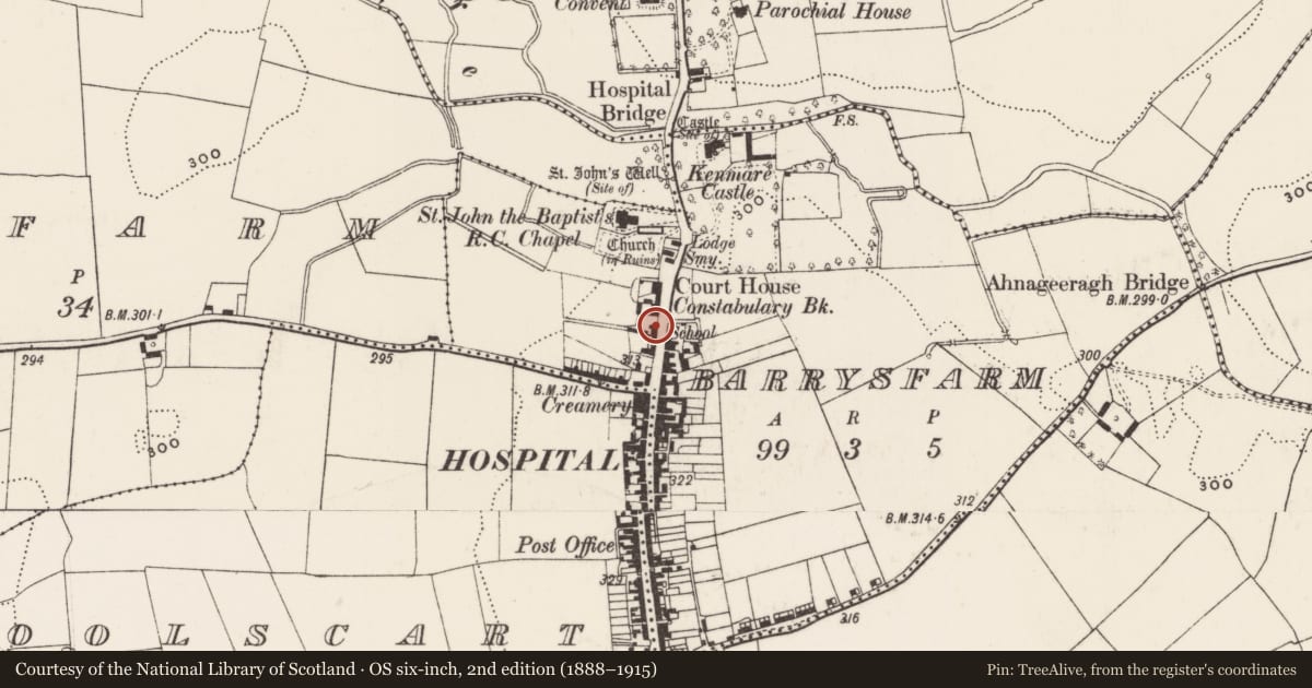
The record
- Townland
- Barrysfarm
- County
- Limerick
- Country
- Ireland
- Latest-edition OS map
- Not indicated
- Coordinates
- 52.47506, -8.43236
- SMR number
- LI032-147001-
Slide toward Today to fade the historical sheet and see the modern map underneath.
David Rumsey Map Collection, Stanford LibrariesDavid Rumsey Map Collection, Stanford LibrariesDavid Rumsey Map Collection, Stanford LibrariesDavid Rumsey Map Collection, Stanford Libraries
4 historical maps cover this location, the earliest the 1790 map "Composite: Ireland." (David Rumsey Map Collection, Stanford Libraries).
Historical maps covering this location
- 1790 · Composite: Ireland. (David Rumsey Map Collection, Stanford Libraries)
- 1882 · Ireland (southern half). (David Rumsey Map Collection, Stanford Libraries)
- 1891 · Ireland 16 (David Rumsey Map Collection, Stanford Libraries)
- 1904 · Sheet 13. (David Rumsey Map Collection, Stanford Libraries)
This record in the National Monuments Service's Historic Environment Viewer ↗
The National Monuments Service's description
The present village of Hospital stands on the site of a medieval settlement probably founded in the 13th century by Geoffrey de Marisco when he established the church of the Knights Hospitallers (LI032-147002-). By the 17th century the clustered settlement consisted of a cluster of dwellings, a church, a castle (LI032-147002-) and watermill (LI032-144----), with a weekly fair and two annual fair days. The 1654-56 Civil Survey of Limerick recorded that Thomas Browne of Hospital & his mother Lady Barbara Browne was in possession of the lands of Hospital on which there was 'two fayres by the yeare a markett ev'ie weeke a Court Leet & Barron a Castle sixtie houses & a Mill seate' (Simington 1938, 96).
Compiled by: Caimin O'Brien
Date of upload: 4 March 2020
See attached ASI aerial photograph ASIAP – 372/2 taken on 05/01/2003.
References
ASIAP - Archaeological Survey of Ireland Aerial Photographs (c. 1996 - c. 2010).
Simington, R.C. (ed.) 1938 The civil survey, AD 1654-1656. Vol. IV: county of Limerick, with a section of Clanmaurice barony Co. Kerry. Dublin. Irish Manuscripts Commission.
Nearby in the register
- Excavation - miscellaneousunder 1 mi
- Graveyardunder 1 mi
- Tomb - effigialunder 1 mi
- Tomb - effigialunder 1 mi
Other entries of the same register within about three miles of this one, by straight line.