Sites and Monuments Record · Ireland
Graveslab
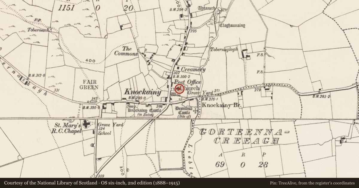
Knockainy West, County Limerick, Ireland
The record
- Townland
- Knockainy West
- County
- Limerick
- Country
- Ireland
- First-edition OS map
- Not indicated
- Latest-edition OS map
- Not indicated
- Coordinates
- 52.47419, -8.46730
- SMR number
- LI032-141008-
Slide toward Today to fade the historical sheet and see the modern map underneath.
David Rumsey Map Collection, Stanford LibrariesDavid Rumsey Map Collection, Stanford LibrariesDavid Rumsey Map Collection, Stanford LibrariesDavid Rumsey Map Collection, Stanford Libraries
4 historical maps cover this location, the earliest the 1790 map "Composite: Ireland." (David Rumsey Map Collection, Stanford Libraries).
Historical maps covering this location
- 1790 · Composite: Ireland. (David Rumsey Map Collection, Stanford Libraries)
- 1882 · Ireland (southern half). (David Rumsey Map Collection, Stanford Libraries)
- 1891 · Ireland 16 (David Rumsey Map Collection, Stanford Libraries)
- 1904 · Sheet 13. (David Rumsey Map Collection, Stanford Libraries)
This record in the National Monuments Service's Historic Environment Viewer ↗
The National Monuments Service's description
The Urban Survey of Limerick (Bradley et. al. 1989, 182) recorded the following about a 17th century cross-slab in Knockainy graveyard (LI032-141005-); "17th century cross slab. This rectangular limestone slab, which is cracked, is on the ground to the east of the church and tower. It has an eight armed fleur-de-lis cross on steps with a chequer-board pattern. There is no inscription. Dims: L. 222cm W. 93cm T. 18cm (min). Described by Rev. Seymour as following; 'In the churchyard is an uninscribed slab, with a late eight-point cross running down the centre, the arms terminating in a Fleur-de-lys' (Seymour 1907-9, 398).
Late 16th/ early 17th century recumbent floriated graveslab located 9m E of the bell-tower of St. John's Church (LI032-141004-) in Knockainy graveyard (LI032-141005-) and 6.4m N of 17th century chest tomb/altar (LI032-141013-). Rectangular slab decorated with an eight-armed ringed cross with central roundel and fleur-de-lis terminals carved in false relief rising from a stepped base decorated with a chequerboard pattern.
Compiled by: Caimin O'Brien
Date of upload: 26 April 2019
References
Bradley, J., Halpin, A., and King, H.A. 1989 Urban archaeological survey - county Limerick (3 vols.). Unpublished report commissioned by the Office of Public Works, Dublin.
Seymour, Rev. St. J. D. 1907-9 County Limerick: Knockainey. Journal of the Association for the Preservation of the Memorials of the Dead in Ireland 7, 397-8.
Nearby in the register
- Churchunder 1 mi
- Altarunder 1 mi
- Graveslabunder 1 mi
- Crucifixion plaqueunder 1 mi
Other entries of the same register within about three miles of this one, by straight line.