Sites and Monuments Record · Ireland
Barrow - ring-barrow
Cahercorney, County Limerick, Ireland
The record
- Townland
- Cahercorney
- County
- Limerick
- Country
- Ireland
- First-edition OS map
- Not indicated
- Latest-edition OS map
- Not indicated
- Coordinates
- 52.52805, -8.49121
- SMR number
- LI032-073001-
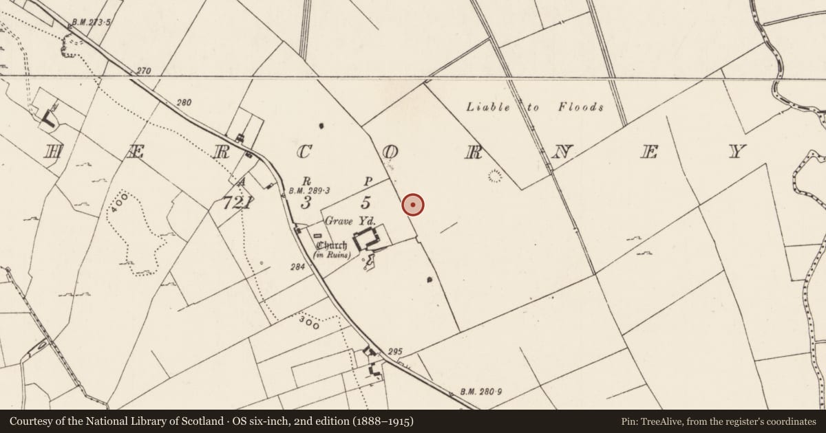
Slide toward Today to fade the historical sheet and see the modern map underneath.
David Rumsey Map Collection, Stanford LibrariesDavid Rumsey Map Collection, Stanford LibrariesDavid Rumsey Map Collection, Stanford LibrariesDavid Rumsey Map Collection, Stanford Libraries
4 historical maps cover this location, the earliest the 1790 map "Composite: Ireland." (David Rumsey Map Collection, Stanford Libraries).
Historical maps covering this location
- 1790 · Composite: Ireland. (David Rumsey Map Collection, Stanford Libraries)
- 1869 · Ireland. (David Rumsey Map Collection, Stanford Libraries)
- 1891 · Ireland 16 (David Rumsey Map Collection, Stanford Libraries)
- 1904 · Sheet 13. (David Rumsey Map Collection, Stanford Libraries)
This record in the National Monuments Service's Historic Environment Viewer ↗
The National Monuments Service's description
One of a complex of 12 monuments (LI032-073001-/013-). Listed by O'Kelly as monument No. 3 and described in 1943 as following; 'This is a very slightly elevated rectangular platform surrounded by a continuous fosse, and is one of the Type A structures. It measures 70' [21m] north-south by 40' [12m], and the platform is barely 1' [0.3m] high. From the south-west corner of the fosse a straight shallow trench runs in a southerly direction and connects into the fosse of monument No. 4. All these monuments, except Nos. 1 to 5 inclusive, are situated in a low-land marsh. Nos. 1, 2, 3, 10, 11 and 12 are not marked on the OS Maps' (O'Kelly 1942-3, 181-2). The outline of the monument is not visible today on Digital Globe aerial photographs.
Compiled by: Caimin O'Brien
Date of upload: 27 February 2020
See attached ASI aerial photograph ASIAP – 351/20 taken 05/01/2003.
References
O'Kelly, M.J. 1942-3 A survey of the antiquities in the barony of Small County, Co. Limerick. North Munster Antiquarian Journal 3, 75-97, 169-84, 222-46.
ASIAP - Archaeological Survey of Ireland Aerial Photographs (c. 1996 - c. 2010).
Nearby in the register
- Barrow - ring-barrowunder 1 mi
- Barrow - ring-barrowunder 1 mi
- Barrow - ring-barrowunder 1 mi
- Barrow - ring-barrowunder 1 mi
Other entries of the same register within about three miles of this one, by straight line.