Sites and Monuments Record · Ireland
Castle - tower house
Kilmacow, County Limerick, Ireland
The record
- Townland
- Kilmacow
- County
- Limerick
- Country
- Ireland
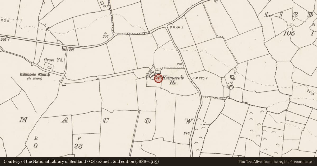
- First-edition OS map
- Kilmacow Ho.
- Latest-edition OS map
- Kilmacow Ho. on Site of Kilmacow Castle
- Coordinates
- 52.49126, -8.79073
- SMR number
- LI030-092001-
Slide toward Today to fade the historical sheet and see the modern map underneath.
David Rumsey Map Collection, Stanford LibrariesDavid Rumsey Map Collection, Stanford LibrariesDavid Rumsey Map Collection, Stanford LibrariesDavid Rumsey Map Collection, Stanford Libraries
4 historical maps cover this location, the earliest the 1790 map "Composite: Ireland." (David Rumsey Map Collection, Stanford Libraries).
Historical maps covering this location
- 1790 · Composite: Ireland. (David Rumsey Map Collection, Stanford Libraries)
- 1883 · Ireland 3. (David Rumsey Map Collection, Stanford Libraries)
- 1891 · Ireland 16 (David Rumsey Map Collection, Stanford Libraries)
- 1904 · Sheet 13. (David Rumsey Map Collection, Stanford Libraries)
This record in the National Monuments Service's Historic Environment Viewer ↗
The National Monuments Service's description
Westropp (1906-7, 225-6) recorded the following details about Kilmacow Castle and bawn; 'An appanage of Keynsham Abbey. 1319 Sybilla de la Chapelle claimed one-third off Kilmecho (Plea R.). 1569 Supple's C[astle]. of Gillemakuo, surrendered (C.S.P.L). 1583 It was held from Earl of Desmond by J. Supple (Peyton, 57b; Inq., Exch., 11,54). "The large square C[astle]. of Killmackwoo,. with nine separate rooms, ruinous in parts. It is surrounded by a strong wall, built strongly for defence." Adjoining were gardens, a rather ruinous water-mill [LI030-187----], orchard, &c. (Des. R., 68). Granted before 1588 by Supple to Billingsley; 1590 by him to Rob. Graves 1593 to Ric. Whittaker; 1598 by him to W. Butler; the C[astle]. being a sufficient residence (Inq. Chan., 6b; Carew i., p. 450); 1623 by Sir J. Dowdall (Inq. Chan, 15a). 1655 W. Butler owned Killmcceow (C.S, p. 43). The Peppard family resided there early in the next century.
Fabric - A large bawn, in which is a nearly levelled tower, which, in human memory, had fine mantelpieces. A farmhouse occupies part of the site. It is on the north slope of Knockfeerina'.
Compiled by: Caimin O'Brien
Date of upload: 9 December 2020
References
Westropp, T.J. 1906-7 The ancient castles of the county of Limerick. Proceedings of the Royal Irish Academy 26, 54-264.
Nearby in the register
- Bawnunder 1 mi
- Enclosureunder 1 mi
- Ringfort - rathunder 1 mi
- Ringfort - rathunder 1 mi
Other entries of the same register within about three miles of this one, by straight line.