Sites and Monuments Record · Ireland
Cairn - unclassified
Kilmacow, County Limerick, Ireland
The record
- Townland
- Kilmacow
- County
- Limerick
- Country
- Ireland
- First-edition OS map
- NULL
- Latest-edition OS map
- Not indicated
- Coordinates
- 52.47434, -8.80847
- SMR number
- LI030-080----
Slide toward Today to fade the historical sheet and see the modern map underneath.
David Rumsey Map Collection, Stanford LibrariesDavid Rumsey Map Collection, Stanford LibrariesDavid Rumsey Map Collection, Stanford LibrariesDavid Rumsey Map Collection, Stanford Libraries
4 historical maps cover this location, the earliest the 1790 map "Composite: Ireland." (David Rumsey Map Collection, Stanford Libraries).
Historical maps covering this location
- 1790 · Composite: Ireland. (David Rumsey Map Collection, Stanford Libraries)
- 1883 · Ireland 3. (David Rumsey Map Collection, Stanford Libraries)
- 1891 · Ireland 16 (David Rumsey Map Collection, Stanford Libraries)
- 1904 · Sheet 13. (David Rumsey Map Collection, Stanford Libraries)
This record in the National Monuments Service's Historic Environment Viewer ↗
The National Monuments Service's description
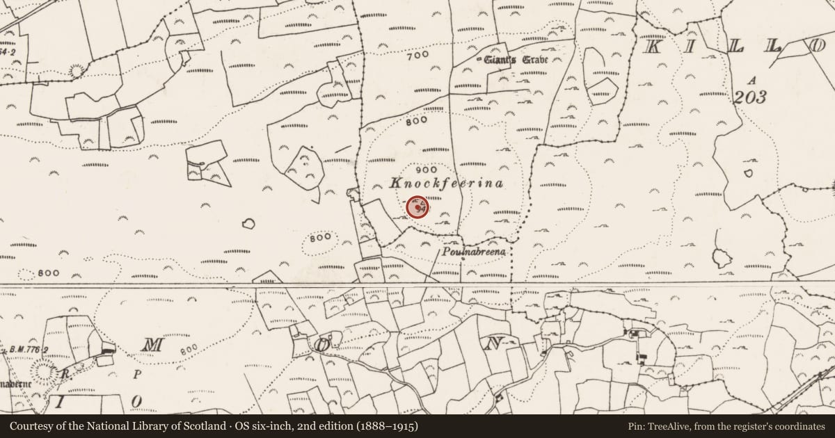
In rough mountain pasture, on the summit of Knockfeerina. A roughly circular flat-topped cairn of stones (22m N-S; 23.5m E-W; H 3.05m at N; 2.8m at E). On its W edge is an abandoned quarry (8m N-S; 6m E-W) where stones have been removed down to underlying bedrock; there are also some small quarried depressions in the SE quadrant of the cairn. Standing in the E quadrant of the cairn is a concrete cross, erected in 1950. Just inside the N edge at the base of the cairn is an OS trigonometrical station. A telecommunications mast stands 10m to the NW. According to MacNeill (1982, vol. 1, 201-6) Knockfeerina 'is one of the most famous fairy hills in Munster ... and gets its name from the fairy-king Donn Fi(fada)rinne' (ibid., 202). The hill was also 'in olden times' (ibid., 205) the site of a Lughnasa assembly. Associated with this was the tradition 'to visit the hill at least once a year and put a stone on the cairn' (ibid.). According to Lynch (1909-11, 108) all the tradition associated with the cairn 'appears to be lost'.
Compiled by: Denis Power
Date of upload: 26 August 2011
Nearby in the register
- Megalithic tomb - wedge tombunder 1 mi
- Barrow - ring-barrowunder 1 mi
- Ringfort - rathunder 1 mi
- Enclosureunder 1 mi
Other entries of the same register within about three miles of this one, by straight line.